Celaya night lights from space
Night Light of Celaya (Guanajuato) from space (Mexico) Src. Average luminocity for 10x10km area is 90.839% and for 50x50km: 30.6313%.
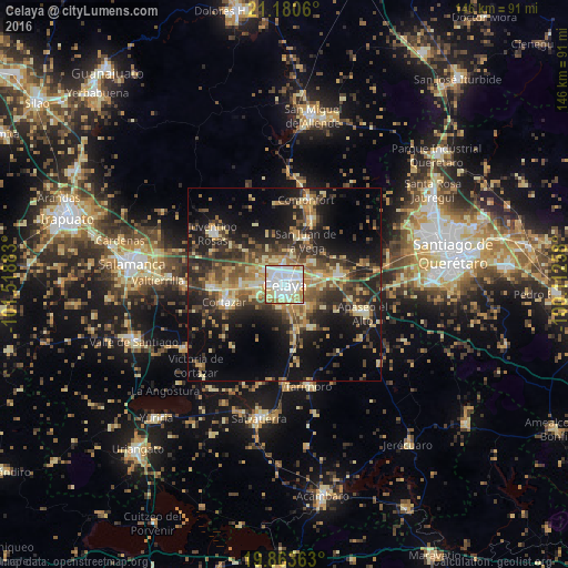
Analysis of Celaya night lights 2016
Square area 10x10 km:
 36.93%
90-99
30.49%80-89
10.42%70-79
13.83%60-69
6.44%50-59
1.14%40-49
0.76%30-39
0%20-29
0%10-19
0%0-9
0%Square area 50x50 km:
2.41%90-99
3.01%80-89
5.9%70-79
5.19%60-69
4.27%50-59
3.91%40-49
6.98%30-39
6.47%20-29
10.17%10-19
16.64%0-9
35.04%Clear (daylight) street map image can be seen on geolist.org.
Map coordinates:
21° 10' 50.2" North, 101° 31' 7.8" West
20° 31' 24.7" North, 100° 48' 56.5" West
19° 51' 49.1" North, 100° 6' 45.3" West
Some cities around Celaya sort by population:
• Cortazar
15.9 km =9.9 mi,  253°
253°
• Villagrán
19 km =11.8 mi,  266°
266°
• Apaseo el Grande
13.9 km =8.6 mi,  80°
80°
• Empalme Escobedo
18.1 km =11.2 mi,  23°
23°
• San Miguel Octopan
9 km =5.6 mi,  51°
51°
• Rincón de Tamayo
12.8 km =8 mi,  150°
150°
• San Juan de la Vega
12.6 km =7.8 mi,  26°
26°
• San José de Agua Azul
17.1 km =10.6 mi,  103°
103°
4014875 (p: 340,387)
Sources (retrieved 2019-11-25):
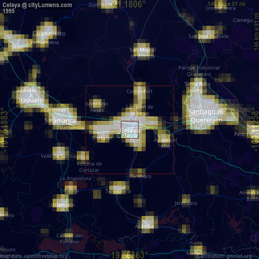
» NASA, Earths city lights 1995
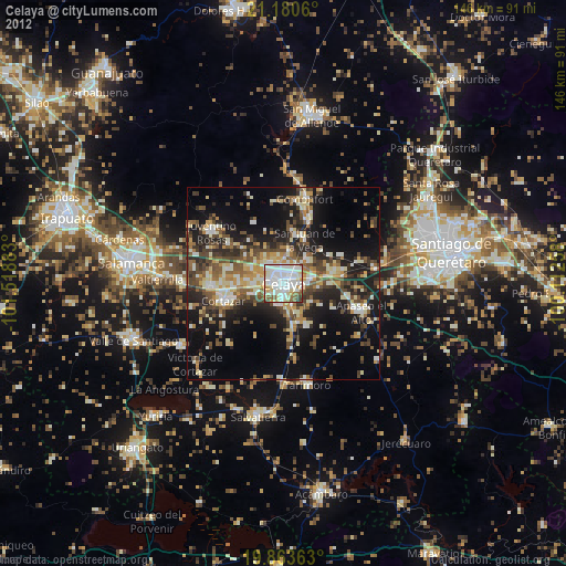
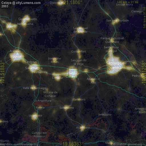
» NASA city lights 2003
» Earth at Night: Flat Maps 2012, 2016