Aguascalientes night lights from space
Night Light of Aguascalientes from space (Mexico) Src. Average luminocity for 10x10km area is 97.504% and for 50x50km: 22.7891%.
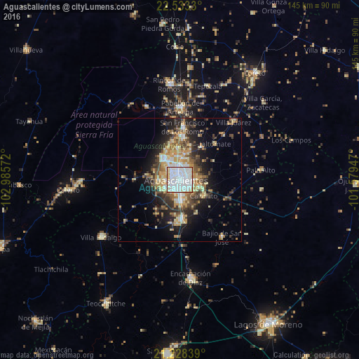
Analysis of Aguascalientes night lights 2016
Square area 10x10 km:
 55.16%
90-99
35.91%80-89
5.56%70-79
3.37%60-69
0%50-59
0%40-49
0%30-39
0%20-29
0%10-19
0%0-9
0%Square area 50x50 km:
3.79%90-99
3.62%80-89
3.49%70-79
3.96%60-69
2.45%50-59
2.57%40-49
3.99%30-39
2.99%20-29
5.58%10-19
9.12%0-9
58.44%Clear (daylight) street map image can be seen on geolist.org.
Map coordinates:
22° 31' 59.9" North, 102° 59' 8.6" West
21° 52' 56.4" North, 102° 16' 57.3" West
21° 13' 42.2" North, 101° 34' 46.1" West
Some cities around Aguascalientes sort by population:
• Jesús María
10.8 km =6.7 mi,  324°
324°
• Pabellón de Arteaga
29.4 km =18.3 mi,  1°
1°
• Rincón de Romos
38.7 km =24 mi,  353°
353°
• San Francisco de los Romo
21.7 km =13.5 mi, 3°
• Jesús Gómez Portugal (Margaritas)
13 km =8.1 mi,  356°
356°
• Jesús Gómez Portugal
12.7 km =7.9 mi, 356°
• Palo Alto
33.1 km =20.6 mi,  83°
83°
• Pocitos
6.9 km =4.3 mi,  309°
309°
4019233 (p: 722,250)
Sources (retrieved 2019-11-25):
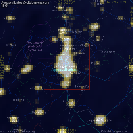
» NASA, Earths city lights 1995
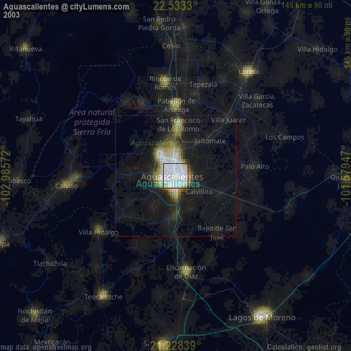
» NASA city lights 2003
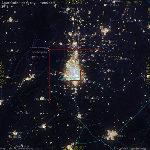
» Earth at Night: Flat Maps 2012, 2016