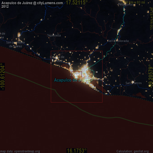
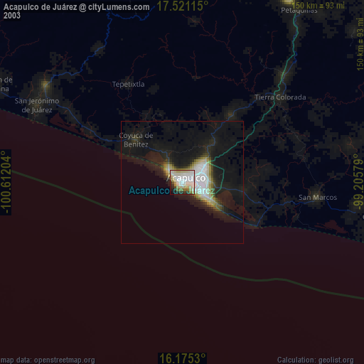
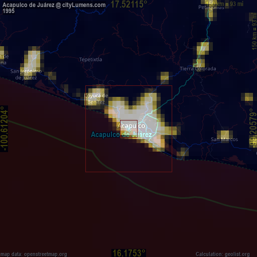
Acapulco de Juárez night lights from space
Night Light of Acapulco de Juárez (Guerrero) from space (Mexico) Src. Average luminocity for 10x10km area is 54.6385% and for 50x50km: 12.7931%.
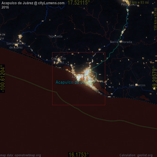
Analysis of Acapulco de Juárez night lights 2016
Square area 10x10 km:
 9.96%
9.96%90-99
11.26%80-89
9.31%70-79
7.79%60-69
9.96%50-59
4.98%40-49
6.71%30-39
5.84%20-29
13.42%10-19
16.02%0-9
4.76%Square area 50x50 km:
1.05%90-99
1.74%80-89
2.44%70-79
2.3%60-69
1.81%50-59
1.48%40-49
2.15%30-39
1.78%20-29
3.39%10-19
7.37%0-9
74.48%Clear (daylight) street map image can be seen on geolist.org.
Map coordinates:
17° 31' 16.1" North, 100° 36' 43.3" West
16° 50' 57.9" North, 99° 54' 32.1" West
16° 10' 31.1" North, 99° 12' 20.8" West
Some cities around Acapulco de Juárez sort by population:
• Coyuca de Benítez
26 km =16.2 mi,  313°
313°
• San Marcos
55.6 km =34.5 mi,  95°
95°
• Tierra Colorada
53.6 km =33.3 mi,  49°
49°
• Xaltianguis
34.5 km =21.4 mi,  36°
36°
• El Ocotito
60.8 km =37.8 mi, 43°
• Kilómetro 30
21.5 km =13.4 mi, 39°
• Bajos del Ejido
14.1 km =8.8 mi,  331°
331°
• Tres Palos
14.1 km =8.8 mi, 99°
3533462 (p: 673,479)
Sources (retrieved 2019-11-25):
» NASA, Earths city lights 1995
» NASA city lights 2003
» Earth at Night: Flat Maps 2012, 2016