Camp Diable night lights from space
Night Light of Camp Diable (Savanne) from space (Mauritius) Src. Average luminocity for 10x10km area is 9.0511% and for 50x50km: 8.7864%.
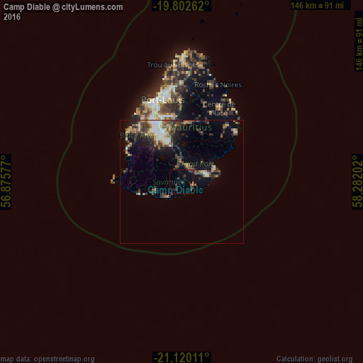
Analysis of Camp Diable night lights 2016
Square area 10x10 km:
 0%
0%90-99
0%80-89
0.76%70-79
0.76%60-69
0.57%50-59
1.7%40-49
1.7%30-39
6.06%20-29
3.03%10-19
2.84%0-9
82.58%Square area 50x50 km:
0.68%90-99
1.38%80-89
1.17%70-79
0.69%60-69
1.08%50-59
1.45%40-49
1.84%30-39
2.16%20-29
2.67%10-19
4.51%0-9
82.38%Clear (daylight) street map image can be seen on geolist.org.
Map coordinates:
19° 48' 9.4" South, 56° 52' 32.8" East
20° 27' 46" South, 57° 34' 44" East
21° 7' 12.4" South, 58° 16' 55.3" East
Some cities around Camp Diable sort by population:
• Rose Belle
7.2 km =4.5 mi,  14°
14°
• Plaine Magnien
10.2 km =6.3 mi,  68°
68°
• Surinam
9.3 km =5.8 mi,  235°
235°
• New Grove
7 km =4.3 mi,  30°
30°
• Rivière des Anguilles
3.8 km =2.4 mi,  229°
229°
• Grand Bois
6.1 km =3.8 mi,  323°
323°
• Nouvelle France
10.4 km =6.5 mi,  349°
349°
• Souillac
8.8 km =5.5 mi, 227°
934660 (p: 5,082)
Sources (retrieved 2019-11-25):
» Earth at Night: Flat Maps 2012, 2016