Zajas night lights from space
Night Light of Zajas (Kichevo) from space (North Macedonia) Src. Average luminocity for 10x10km area is 0.8815% and for 50x50km: 1.3636%.
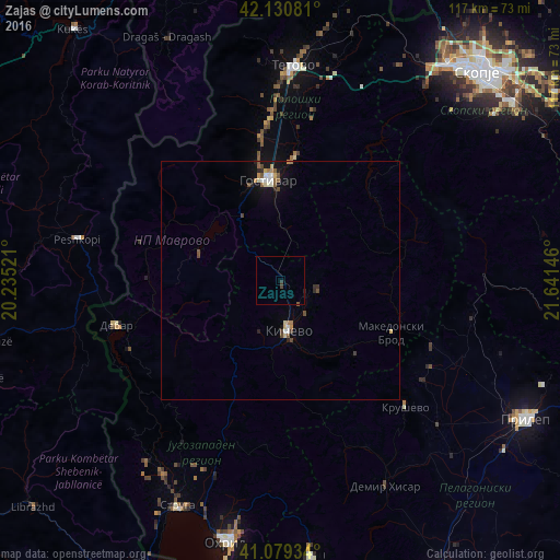
Analysis of Zajas night lights 2016
Square area 10x10 km:
 0%
0%90-99
0%80-89
0%70-79
0%60-69
0%50-59
0.32%40-49
0.49%30-39
0.81%20-29
0%10-19
0%0-9
98.38%Square area 50x50 km:
0.13%90-99
0.18%80-89
0.18%70-79
0.1%60-69
0.19%50-59
0.25%40-49
0.32%30-39
0.13%20-29
0.25%10-19
0.76%0-9
97.52%Clear (daylight) street map image can be seen on geolist.org.
Map coordinates:
42° 7' 50.9" North, 20° 14' 6.8" East
41° 36' 26" North, 20° 56' 18" East
41° 4' 45.6" North, 21° 38' 29.3" East
Some cities around Zajas sort by population:
• Gostivar
21.1 km =13.1 mi,  353°
353°
• Kičevo
10.7 km =6.6 mi,  170°
170°
• Cegrane
25.9 km =16.1 mi,  6°
6°
• Dolna Banjica
20.1 km =12.5 mi, 352°
• Vrapčište
25.6 km =15.9 mi, 350°
• Vrutok
19.7 km =12.2 mi,  335°
335°
• Makedonski Brod
25.3 km =15.7 mi,  114°
114°
• Plasnica
21.9 km =13.6 mi,  135°
135°
784027 (p: 12,218)
Sources (retrieved 2019-11-25):
» Earth at Night: Flat Maps 2012, 2016