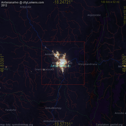
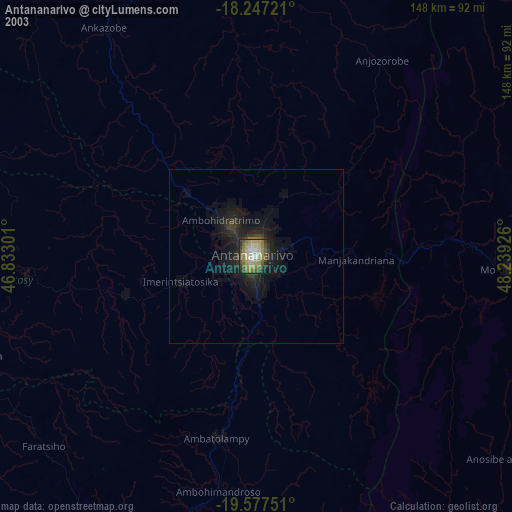
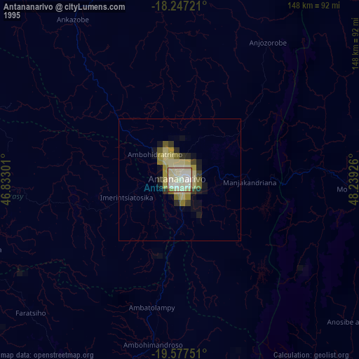
Antananarivo night lights from space
Night Light of Antananarivo (Analamanga) from space (Madagascar) Src. Average luminocity for 10x10km area is 76.6429% and for 50x50km: 7.6847%.
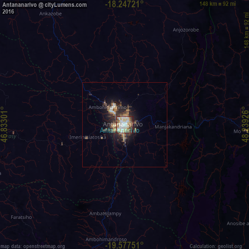
Analysis of Antananarivo night lights 2016
Square area 10x10 km:
 17.53%
90-99
25.11%80-89
17.32%70-79
6.28%60-69
4.98%50-59
9.74%40-49
10.61%30-39
4.55%20-29
3.68%10-19
0.22%0-9
0%Square area 50x50 km:
0.78%90-99
1.37%80-89
1.25%70-79
0.7%60-69
0.84%50-59
1%40-49
1.47%30-39
1.71%20-29
2.6%10-19
4.55%0-9
83.74%Clear (daylight) street map image can be seen on geolist.org.
Map coordinates:
18° 14' 50" South, 46° 49' 58.8" East
18° 54' 49.2" South, 47° 32' 10.1" East
19° 34' 39" South, 48° 14' 21.3" East
Some cities around Antananarivo sort by population:
• Manjakandriana
27.8 km =17.3 mi,  90°
90°
• Ambohitrolomahitsy
28.4 km =17.6 mi,  33°
33°
• Alarobia
21.6 km =13.4 mi,  105°
105°
• Miadanandriana
29.2 km =18.1 mi,  117°
117°
• Ambohitrandriamanitra
32.1 km =19.9 mi,  125°
125°
• Sambaina
26 km =16.2 mi, 86°
• Ambohitseheno
31.3 km =19.4 mi,  62°
62°
• Anjepy
20.3 km =12.6 mi,  69°
69°
1070940 (p: 1,391,433)
Sources (retrieved 2019-11-25):
» NASA, Earths city lights 1995
» NASA city lights 2003
» Earth at Night: Flat Maps 2012, 2016