Šiauliai night lights from space
Night Light of Šiauliai (Siauliai) from space (Lithuania) Src. Average luminocity for 10x10km area is 43.1266% and for 50x50km: 2.2951%.
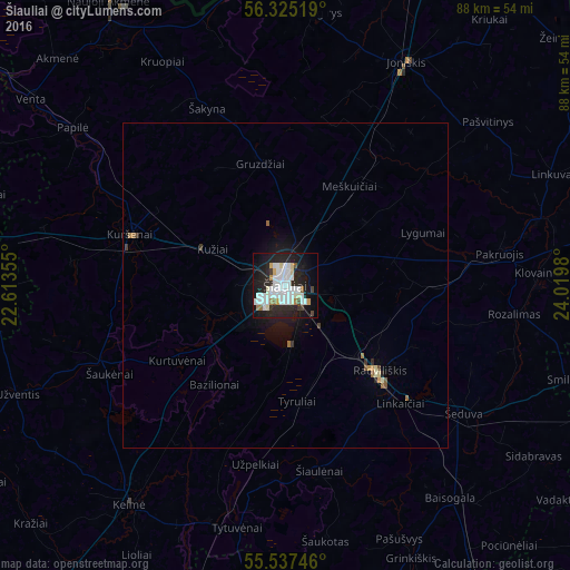
Analysis of Šiauliai night lights 2016
Square area 10x10 km:
 13.91%
90-99
13.28%80-89
2.51%70-79
2.26%60-69
2.01%50-59
1.5%40-49
1.88%30-39
1.5%20-29
17.79%10-19
27.44%0-9
15.91%Square area 50x50 km:
0.54%90-99
0.53%80-89
0.16%70-79
0.15%60-69
0.18%50-59
0.16%40-49
0.15%30-39
0.13%20-29
0.75%10-19
1.9%0-9
95.35%Clear (daylight) street map image can be seen on geolist.org.
Map coordinates:
56° 19' 30.7" North, 22° 36' 48.8" East
55° 55' 60" North, 23° 19' 0" East
55° 32' 14.9" North, 24° 1' 11.3" East
Some cities around Šiauliai sort by population:
• Radviliskis
18.7 km =11.6 mi,  133°
133°
• Kuršėnai
24.9 km =15.5 mi,  288°
288°
• Raseiniai
62.7 km =39 mi,  191°
191°
• Naujoji Akmene
49.8 km =30.9 mi,  328°
328°
• Joniškis
38.7 km =24 mi,  28°
28°
• Kelmė
41.3 km =25.7 mi,  215°
215°
• Pakruojis
33.9 km =21.1 mi,  81°
81°
• Zelmeņi, LV
57.7 km =35.9 mi,  2°
2°
594739 (p: 130,587)
Sources (retrieved 2019-11-25):
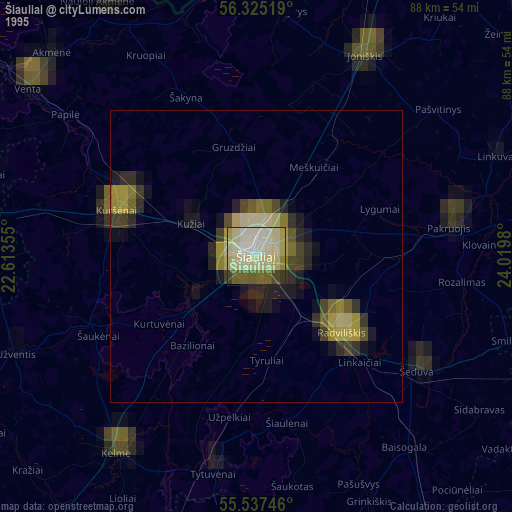
» NASA, Earths city lights 1995
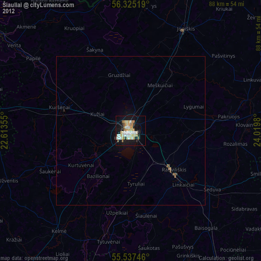
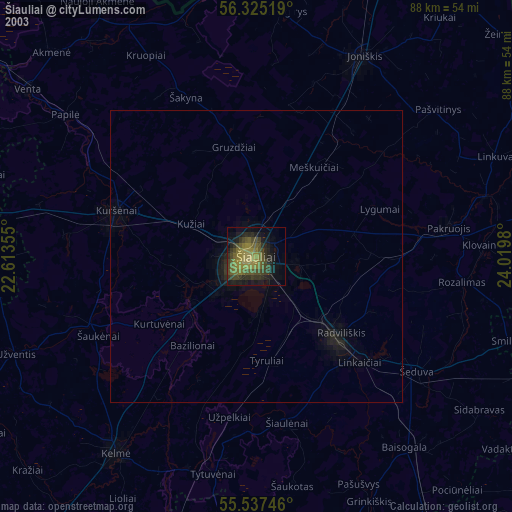
» NASA city lights 2003
» Earth at Night: Flat Maps 2012, 2016