Seoul night lights from space
Night Light of Seoul from space (South Korea) Src. Average luminocity for 10x10km area is 99.5536% and for 50x50km: 85.0688%.
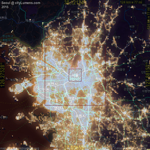

Analysis of Seoul night lights 2016
Square area 10x10 km:
 85.55%
90-99
12.82%80-89
1.62%70-79
0%60-69
0%50-59
0%40-49
0%30-39
0%20-29
0%10-19
0%0-9
0%Square area 50x50 km:
33.63%90-99
22.1%80-89
13.49%70-79
11.96%60-69
7.26%50-59
4.28%40-49
3.61%30-39
2.2%20-29
1.21%10-19
0.26%0-9
0%Clear (daylight) street map image can be seen on geolist.org.
Map coordinates:
38° 7' 16.5" North, 126° 16' 31" East
37° 33' 57.6" North, 126° 58' 42.2" East
37° 0' 23.7" North, 127° 40' 53.5" East
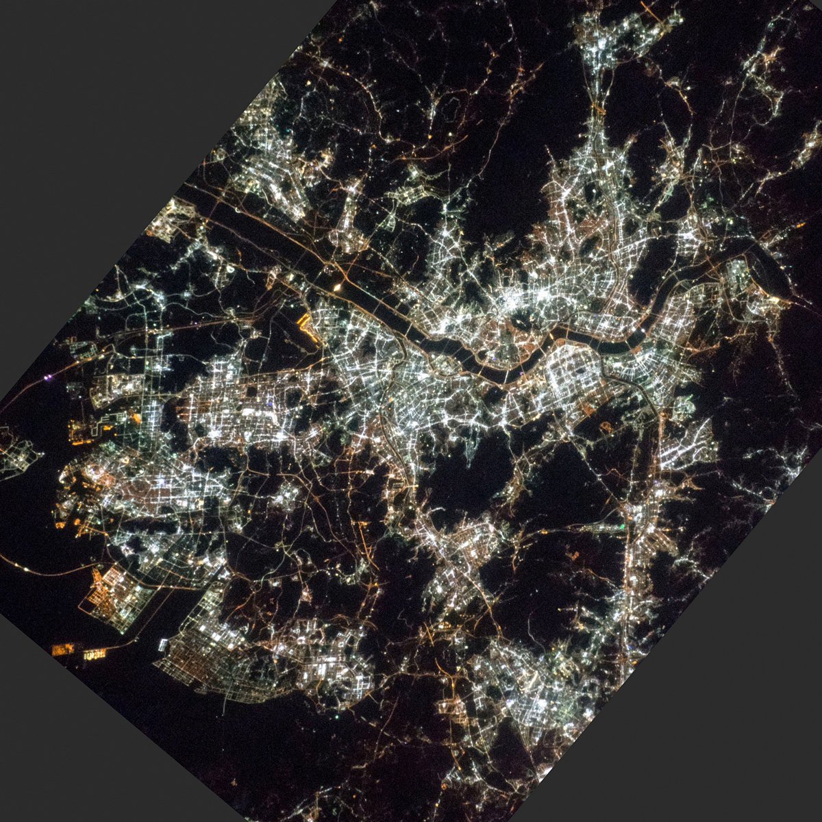
Fantastic image of Seoul from space taken by astronauts [src2], but I don't have information about it's orientation, scale or angle. If necessary, it was rotated manually, so North points approximately to upper direction. Click to zoom in:
Some cities around Seoul sort by population:
• Goyang-si
16.1 km =10 mi,  308°
308°
• Seongnam-si
20 km =12.4 mi,  135°
135°
• Bucheon-si
18.8 km =11.7 mi,  246°
246°
• Anyang-si
19.8 km =12.3 mi,  193°
193°
• KwangmyĹŹng
14 km =8.7 mi,  225°
225°
• Guri-si
14.6 km =9.1 mi,  75°
75°
• Hanam
20.2 km =12.6 mi,  98°
98°
• Yongsan-dong
2.4 km =1.5 mi,  168°
168°
1835848 (p: 10,349,312)
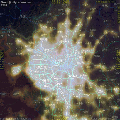
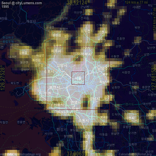
Sources (retrieved 2019-11-25):
» NASA, Earths city lights 1995
» NASA city lights 2003
» Earth at Night: Flat Maps 2012, 2016
Src.2: Shane Kimbrough Twitter@astro_kimbrough 2017-02-13