Villacidro night lights from space
Night Light of Villacidro (Sardinia) from space (Italy) Src. Average luminocity for 10x10km area is 11.8282% and for 50x50km: 7.5995%.
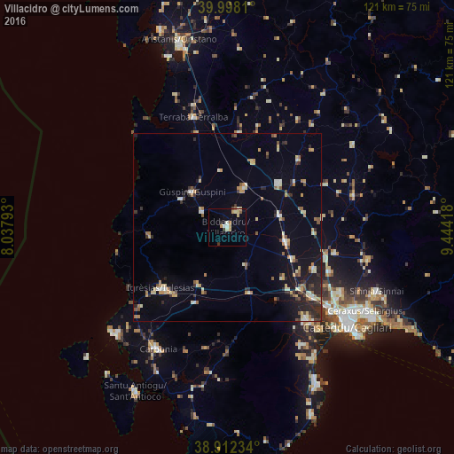
Analysis of Villacidro night lights 2016
Square area 10x10 km:
 0.85%
0.85%90-99
2.04%80-89
2.55%70-79
2.55%60-69
0.85%50-59
1.02%40-49
0.34%30-39
1.36%20-29
0.68%10-19
1.19%0-9
86.56%Square area 50x50 km:
0.5%90-99
1%80-89
1.18%70-79
1.16%60-69
0.82%50-59
0.84%40-49
0.63%30-39
1.09%20-29
1.87%10-19
3.56%0-9
87.35%Clear (daylight) street map image can be seen on geolist.org.
Map coordinates:
39° 59' 53.2" North, 8° 2' 16.5" East
39° 27' 26.4" North, 8° 44' 27.8" East
38° 54' 44.4" North, 9° 26' 39" East
Some cities around Villacidro sort by population:
• Guspini
12.9 km =8 mi,  315°
315°
• San Gavino Monreale
11.2 km =7 mi,  22°
22°
• Serramanna
16 km =9.9 mi,  103°
103°
• Sanluri
17.9 km =11.1 mi,  49°
49°
• Gonnosfanadiga
7.9 km =4.9 mi,  301°
301°
• Domusnovas
16.8 km =10.4 mi,  208°
208°
• Arbus
14.3 km =8.9 mi, 302°
• Samassi
14.4 km =8.9 mi,  78°
78°
2522766 (p: 12,768)
Sources (retrieved 2019-11-25):
» Earth at Night: Flat Maps 2012, 2016