Frignano night lights from space
Night Light of Frignano (Campania) from space (Italy) Src. Average luminocity for 10x10km area is 74.9286% and for 50x50km: 45.7662%.
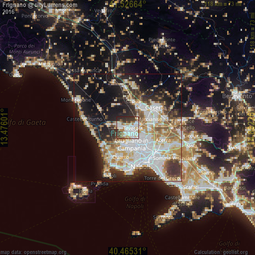
Analysis of Frignano night lights 2016
Square area 10x10 km:
 24.15%
90-99
24.66%80-89
6.63%70-79
6.8%60-69
5.1%50-59
7.82%40-49
5.27%30-39
11.9%20-29
7.65%10-19
0%0-9
0%Square area 50x50 km:
11.85%90-99
11.05%80-89
4.48%70-79
5.59%60-69
5.36%50-59
5.24%40-49
3.64%30-39
5.7%20-29
8.26%10-19
18.71%0-9
20.12%Clear (daylight) street map image can be seen on geolist.org.
Map coordinates:
41° 31' 35.9" North, 13° 28' 33.6" East
40° 59' 53.2" North, 14° 10' 44.9" East
40° 27' 55.1" North, 14° 52' 56.1" East
Some cities around Frignano sort by population:
• Aversa
3.7 km =2.3 mi,  140°
140°
• Trentola-Ducenta
2.6 km =1.6 mi,  187°
187°
• Lusciano
3.3 km =2.1 mi,  163°
163°
• San Marcellino
0.9 km =0.6 mi,  197°
197°
• Teverola
2.4 km =1.5 mi,  96°
96°
• Casaluce
1.5 km =0.9 mi,  91°
91°
• Casapesenna
3.7 km =2.3 mi,  258°
258°
• Villa di Briano
1.6 km =1 mi,  277°
277°
6534263 (p: 8,487)
Sources (retrieved 2019-11-25):
» Earth at Night: Flat Maps 2012, 2016