Viareggio night lights from space
Night Light of Viareggio (Tuscany) from space (Italy) Src. Average luminocity for 10x10km area is 52.0825% and for 50x50km: 20.9553%.
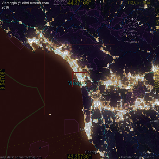
Analysis of Viareggio night lights 2016
Square area 10x10 km:
 15.08%
90-99
14.29%80-89
3.97%70-79
3.02%60-69
2.7%50-59
7.94%40-49
5.71%30-39
5.56%20-29
19.21%10-19
14.6%0-9
7.94%Square area 50x50 km:
3.11%90-99
4.19%80-89
1.68%70-79
2.29%60-69
2.45%50-59
3.02%40-49
3.36%30-39
3.59%20-29
8.85%10-19
13.08%0-9
54.37%Clear (daylight) street map image can be seen on geolist.org.
Map coordinates:
44° 22' 18.1" North, 9° 32' 49.5" East
43° 52' 0.9" North, 10° 15' 0.7" East
43° 21' 28.3" North, 10° 57' 12" East
Some cities around Viareggio sort by population:
• Camaiore
9.2 km =5.7 mi,  24°
24°
• Pietrasanta
10.4 km =6.5 mi,  350°
350°
• Torre del Lago Puccini
5.3 km =3.3 mi,  143°
143°
• Massarosa
7.6 km =4.7 mi,  90°
90°
• Ripa-Pozzi-Querceta-Ponterosso
12.9 km =8 mi,  343°
343°
• Capanne-Prato-Cinquale
16.3 km =10.1 mi,  332°
332°
• Forte dei Marmi
12.4 km =7.7 mi, 330°
• Vecchiano-Nodica
14.2 km =8.8 mi,  130°
130°
3164433 (p: 49,099)
Sources (retrieved 2019-11-25):
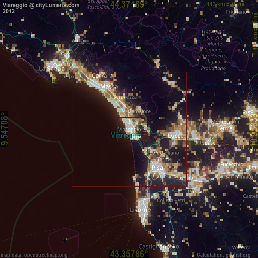
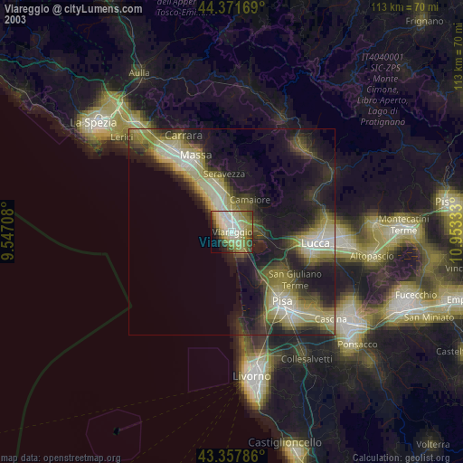
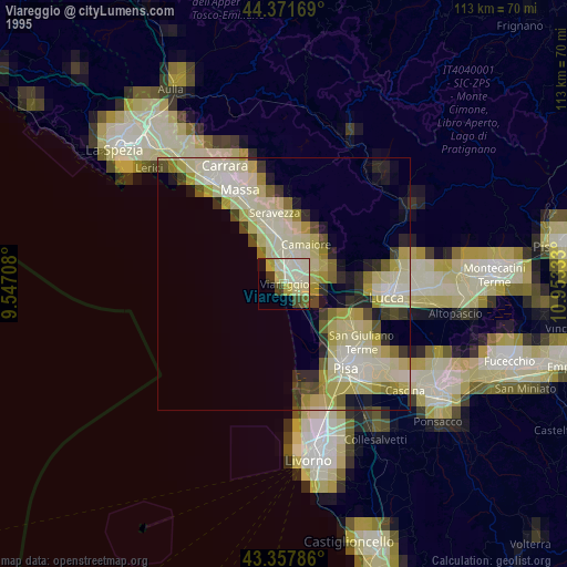
» NASA, Earths city lights 1995
» NASA city lights 2003
» Earth at Night: Flat Maps 2012, 2016