Torrita di Siena night lights from space
Night Light of Torrita di Siena (Tuscany) from space (Italy) Src. Average luminocity for 10x10km area is 12.1545% and for 50x50km: 5.685%.
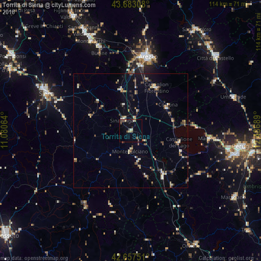
Analysis of Torrita di Siena night lights 2016
Square area 10x10 km:
 0.15%
0.15%90-99
1.82%80-89
1.97%70-79
0.91%60-69
0.76%50-59
3.48%40-49
0.91%30-39
1.82%20-29
2.27%10-19
3.48%0-9
82.42%Square area 50x50 km:
0.21%90-99
0.89%80-89
0.71%70-79
0.68%60-69
0.6%50-59
1.1%40-49
0.94%30-39
0.63%20-29
0.81%10-19
1.57%0-9
91.85%Clear (daylight) street map image can be seen on geolist.org.
Map coordinates:
43° 40' 59.1" North, 11° 4' 50.3" East
43° 10' 20.8" North, 11° 47' 1.5" East
42° 39' 27" North, 12° 29' 12.8" East
Some cities around Torrita di Siena sort by population:
• Arezzo
33.2 km =20.6 mi,  13°
13°
• Castiglion Fiorentino
21.9 km =13.6 mi,  30°
30°
• Sinalunga
5.7 km =3.5 mi,  326°
326°
• Abbadia San Salvatore
33.6 km =20.9 mi,  195°
195°
• Foiano della Chiana
9.4 km =5.8 mi,  16°
16°
• Chianciano Terme
14.7 km =9.1 mi,  171°
171°
• Camucia-Monsigliolo
18 km =11.2 mi,  57°
57°
• Castiglione del Lago
21.4 km =13.3 mi,  104°
104°
3165381 (p: 5,347)
Sources (retrieved 2019-11-25):
» Earth at Night: Flat Maps 2012, 2016