Teverola night lights from space
Night Light of Teverola (Campania) from space (Italy) Src. Average luminocity for 10x10km area is 79.7347% and for 50x50km: 47.6123%.
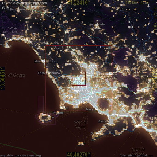
Analysis of Teverola night lights 2016
Square area 10x10 km:
 28.57%
90-99
25.68%80-89
6.8%70-79
9.52%60-69
5.44%50-59
6.97%40-49
3.74%30-39
8.84%20-29
4.42%10-19
0%0-9
0%Square area 50x50 km:
12.03%90-99
11.43%80-89
4.7%70-79
6.19%60-69
6.15%50-59
5.34%40-49
3.85%30-39
5.94%20-29
8.37%10-19
18.07%0-9
17.93%Clear (daylight) street map image can be seen on geolist.org.
Map coordinates:
41° 31' 27" North, 13° 30' 16.2" East
40° 59' 44.2" North, 14° 12' 27.5" East
40° 27' 46" North, 14° 54' 38.7" East
Some cities around Teverola sort by population:
• Aversa
2.6 km =1.6 mi,  180°
180°
• Trentola-Ducenta
3.6 km =2.2 mi,  230°
230°
• Lusciano
3.2 km =2 mi,  206°
206°
• San Marcellino
2.7 km =1.7 mi,  256°
256°
• Gricignano di Aversa
2.6 km =1.6 mi,  132°
132°
• Casaluce
0.9 km =0.6 mi,  285°
285°
• Frignano
2.4 km =1.5 mi,  276°
276°
• Carinaro
1.7 km =1.1 mi,  144°
144°
6534266 (p: 12,175)
Sources (retrieved 2019-11-25):
» Earth at Night: Flat Maps 2012, 2016