Termini Imerese night lights from space
Night Light of Termini Imerese (Sicily) from space (Italy) Src. Average luminocity for 10x10km area is 23.9821% and for 50x50km: 8.4364%.
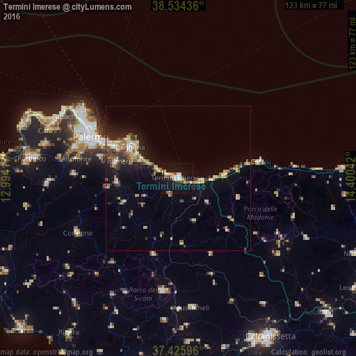
Analysis of Termini Imerese night lights 2016
Square area 10x10 km:
 4.06%
4.06%90-99
3.25%80-89
3.41%70-79
2.27%60-69
1.62%50-59
2.92%40-49
2.27%30-39
2.92%20-29
1.3%10-19
40.58%0-9
35.39%Square area 50x50 km:
0.71%90-99
0.78%80-89
1.46%70-79
1.11%60-69
1.05%50-59
1.47%40-49
1.1%30-39
1.32%20-29
1.81%10-19
5.87%0-9
83.32%Clear (daylight) street map image can be seen on geolist.org.
Map coordinates:
38° 32' 3.7" North, 12° 59' 39" East
37° 58' 56.1" North, 13° 41' 50.2" East
37° 25' 33.5" North, 14° 24' 1.5" East
Some cities around Termini Imerese sort by population:
• Bagheria
19.4 km =12.1 mi,  303°
303°
• Casteldaccia
16.5 km =10.3 mi, 297°
• Santa Flavia
19.8 km =12.3 mi,  313°
313°
• Trabia
6.1 km =3.8 mi,  293°
293°
• Caccamo
6 km =3.7 mi,  205°
205°
• Campofelice di Roccella
15.7 km =9.8 mi,  85°
85°
• Altavilla Milicia
14.4 km =8.9 mi, 295°
• Cerda
13.4 km =8.3 mi,  129°
129°
2522960 (p: 22,957)
Sources (retrieved 2019-11-25):
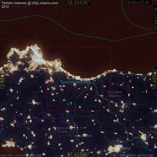
» Earth at Night: Flat Maps 2012, 2016