Paola night lights from space
Night Light of Paola (Calabria) from space (Italy) Src. Average luminocity for 10x10km area is 18.6088% and for 50x50km: 13.6967%.
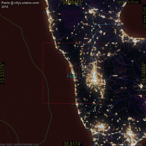
Analysis of Paola night lights 2016
Square area 10x10 km:
 0.85%
0.85%90-99
0.51%80-89
2.04%70-79
2.72%60-69
3.74%50-59
4.93%40-49
2.38%30-39
2.55%20-29
1.02%10-19
23.81%0-9
55.44%Square area 50x50 km:
0.74%90-99
1.19%80-89
2.12%70-79
2.08%60-69
2.49%50-59
2.9%40-49
1.58%30-39
2.81%20-29
3.7%10-19
7.86%0-9
72.54%Clear (daylight) street map image can be seen on geolist.org.
Map coordinates:
39° 54' 16.7" North, 15° 20' 1.6" East
39° 21' 47.3" North, 16° 2' 12.9" East
38° 49' 2.6" North, 16° 44' 24.1" East
Some cities around Paola sort by population:
• Cosenza
19.9 km =12.4 mi,  111°
111°
• Quattromiglia
17.4 km =10.8 mi,  96°
96°
• Acri
33.5 km =20.8 mi,  63°
63°
• Amantea
26.5 km =16.5 mi,  172°
172°
• Andreotta
16.7 km =10.4 mi, 111°
• Belvedere Marittimo
32.2 km =20 mi,  332°
332°
• Roggiano Gravina
30.3 km =18.8 mi,  20°
20°
• Bisignano
26.4 km =16.4 mi,  52°
52°
2523888 (p: 12,649)
Sources (retrieved 2019-11-25):
» Earth at Night: Flat Maps 2012, 2016