Livorno night lights from space
Night Light of Livorno (Tuscany) from space (Italy) Src. Average luminocity for 10x10km area is 55.3429% and for 50x50km: 14.8045%.
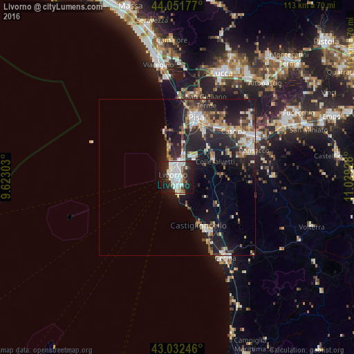
Analysis of Livorno night lights 2016
Square area 10x10 km:
 23.17%
90-99
14.44%80-89
2.38%70-79
2.54%60-69
0.48%50-59
3.33%40-49
3.02%30-39
5.87%20-29
23.02%10-19
20.79%0-9
0.95%Square area 50x50 km:
2.39%90-99
2.86%80-89
1.28%70-79
1.68%60-69
1.53%50-59
1.46%40-49
2%30-39
2.23%20-29
6.34%10-19
11.71%0-9
66.54%Clear (daylight) street map image can be seen on geolist.org.
Map coordinates:
44° 3' 6.4" North, 9° 37' 22.9" East
43° 32' 39.4" North, 10° 19' 34.1" East
43° 1' 56.9" North, 11° 1' 45.4" East
Some cities around Livorno sort by population:
• Pisa
19.3 km =12 mi,  18°
18°
• Cascina
23.5 km =14.6 mi,  51°
51°
• Rosignano Solvay-Castiglioncello
19.4 km =12.1 mi,  152°
152°
• Ponsacco
25.7 km =16 mi,  70°
70°
• Marina di Pisa-Tirrenia-Calambrone
9.6 km =6 mi,  343°
343°
• Vecchiano-Nodica
27 km =16.8 mi,  9°
9°
• Fornacette
25.1 km =15.6 mi,  56°
56°
• Vicopisano
26.5 km =16.5 mi, 51°
3174659 (p: 153,773)
Sources (retrieved 2019-11-25):
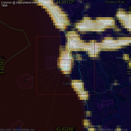
» NASA, Earths city lights 1995
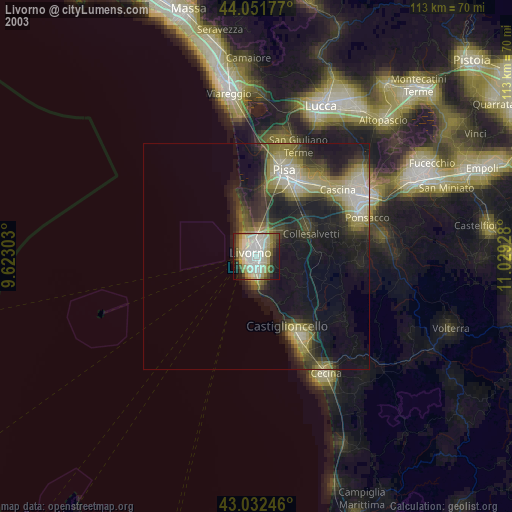
» NASA city lights 2003
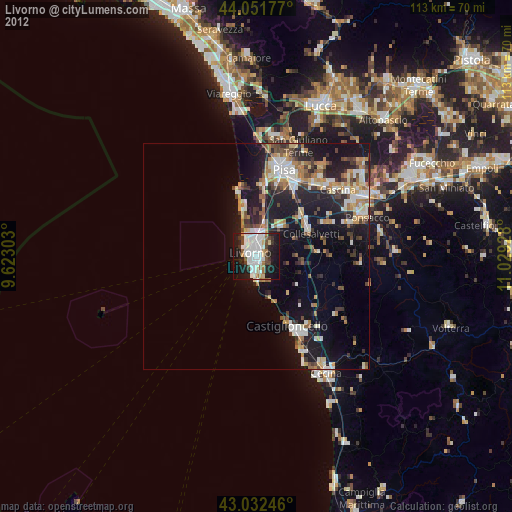
» Earth at Night: Flat Maps 2012, 2016