Lercara Friddi night lights from space
Night Light of Lercara Friddi (Sicily) from space (Italy) Src. Average luminocity for 10x10km area is 4.1497% and for 50x50km: 4.4636%.
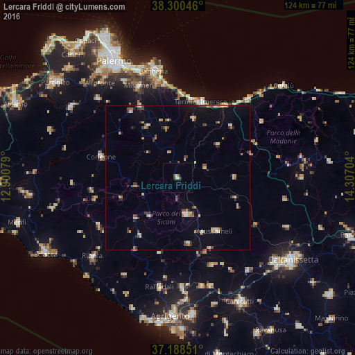
Analysis of Lercara Friddi night lights 2016
Square area 10x10 km:
 0.17%
0.17%90-99
0.68%80-89
1.19%70-79
0%60-69
0%50-59
0.68%40-49
0.68%30-39
1.36%20-29
0.68%10-19
0.34%0-9
94.22%Square area 50x50 km:
0.34%90-99
0.36%80-89
0.84%70-79
0.59%60-69
0.34%50-59
0.49%40-49
0.65%30-39
0.89%20-29
0.65%10-19
1.11%0-9
93.73%Clear (daylight) street map image can be seen on geolist.org.
Map coordinates:
38° 18' 1.7" North, 12° 54' 2.8" East
37° 44' 47.7" North, 13° 36' 14.1" East
37° 11' 18.6" North, 14° 18' 25.3" East
Some cities around Lercara Friddi sort by population:
• Termini Imerese
27.5 km =17.1 mi,  17°
17°
• Corleone
27.6 km =17.1 mi,  285°
285°
• Mussomeli
22.6 km =14 mi,  144°
144°
• San Giovanni Gemini
13.7 km =8.5 mi,  165°
165°
• Casteltermini
23.4 km =14.5 mi, 170°
• Caccamo
21.5 km =13.4 mi, 15°
• Cammarata
12.7 km =7.9 mi, 170°
• Cerda
25.6 km =15.9 mi,  46°
46°
2524402 (p: 6,687)
Sources (retrieved 2019-11-25):
» Earth at Night: Flat Maps 2012, 2016