Lentini night lights from space
Night Light of Lentini (Sicily) from space (Italy) Src. Average luminocity for 10x10km area is 28.2024% and for 50x50km: 17.4266%.
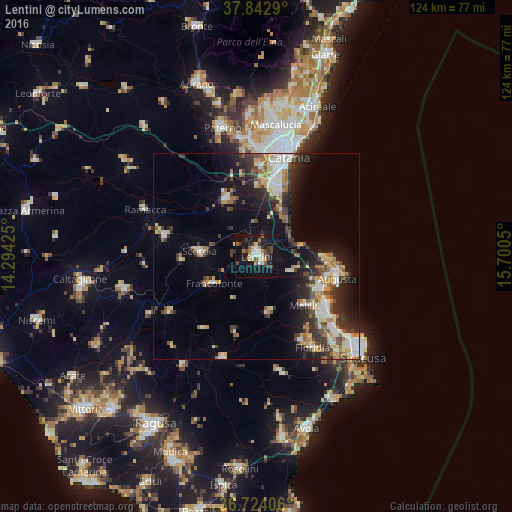
Analysis of Lentini night lights 2016
Square area 10x10 km:
 3.4%
3.4%90-99
4.08%80-89
3.74%70-79
2.55%60-69
3.06%50-59
3.57%40-49
4.59%30-39
5.44%20-29
6.46%10-19
37.07%0-9
26.02%Square area 50x50 km:
2.59%90-99
2.49%80-89
2.47%70-79
2.16%60-69
2.24%50-59
1.74%40-49
2.42%30-39
3.44%20-29
4.65%10-19
9.95%0-9
65.85%Clear (daylight) street map image can be seen on geolist.org.
Map coordinates:
37° 50' 34.4" North, 14° 17' 39.3" East
37° 17' 8" North, 14° 59' 50.5" East
36° 43' 26.6" North, 15° 42' 1.8" East
Some cities around Lentini sort by population:
• Augusta
20.4 km =12.7 mi,  104°
104°
• Scordia
13.9 km =8.6 mi,  274°
274°
• Carlentini
1.3 km =0.8 mi,  115°
115°
• Francofonte
12.8 km =8 mi,  238°
238°
• Priolo Gargallo
21.9 km =13.6 mi,  131°
131°
• Sortino
14.4 km =8.9 mi,  168°
168°
• Militello in Val di Catania
18.1 km =11.2 mi, 266°
• Melilli
16.8 km =10.4 mi,  135°
135°
2524410 (p: 24,102)
Sources (retrieved 2019-11-25):
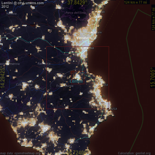
» Earth at Night: Flat Maps 2012, 2016