Francofonte night lights from space
Night Light of Francofonte (Sicily) from space (Italy) Src. Average luminocity for 10x10km area is 10.398% and for 50x50km: 11.6201%.
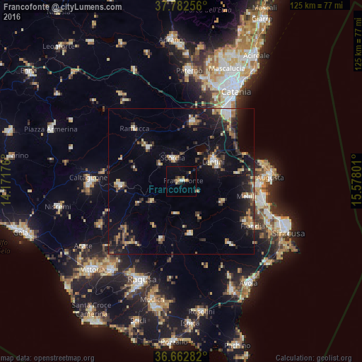
Analysis of Francofonte night lights 2016
Square area 10x10 km:
 1.02%
1.02%90-99
0.34%80-89
1.36%70-79
2.38%60-69
1.53%50-59
0.51%40-49
0.34%30-39
2.21%20-29
2.21%10-19
0.68%0-9
87.41%Square area 50x50 km:
1.03%90-99
1.08%80-89
1.49%70-79
1.26%60-69
1.56%50-59
1.35%40-49
1.52%30-39
2.66%20-29
3.1%10-19
8.64%0-9
76.3%Clear (daylight) street map image can be seen on geolist.org.
Map coordinates:
37° 46' 57.2" North, 14° 10' 18.3" East
37° 13' 29.2" North, 14° 52' 29.6" East
36° 39' 46.2" North, 15° 34' 40.8" East
Some cities around Francofonte sort by population:
• Lentini
12.8 km =8 mi,  58°
58°
• Scordia
8.4 km =5.2 mi,  338°
338°
• Palagonia
16.4 km =10.2 mi,  315°
315°
• Carlentini
13.5 km =8.4 mi, 62°
• Sortino
15.6 km =9.7 mi,  118°
118°
• Palazzolo Acreide
18.2 km =11.3 mi,  171°
171°
• Militello in Val di Catania
9.2 km =5.7 mi,  308°
308°
• Vizzini
12.6 km =7.8 mi,  236°
236°
2524704 (p: 12,635)
Sources (retrieved 2019-11-25):
» Earth at Night: Flat Maps 2012, 2016