Desenzano del Garda night lights from space
Night Light of Desenzano del Garda (Lombardy) from space (Italy) Src. Average luminocity for 10x10km area is 53.6079% and for 50x50km: 35.9945%.
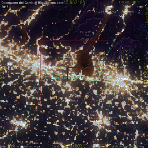

Analysis of Desenzano del Garda night lights 2016
Square area 10x10 km:
 9.68%
9.68%90-99
12.54%80-89
4.29%70-79
4.6%60-69
6.03%50-59
7.46%40-49
12.06%30-39
14.44%20-29
23.17%10-19
5.71%0-9
0%Square area 50x50 km:
4.73%90-99
6.39%80-89
3.01%70-79
3.72%60-69
4.69%50-59
5.56%40-49
7.02%30-39
8.12%20-29
15.02%10-19
24.96%0-9
16.78%Clear (daylight) street map image can be seen on geolist.org.
Map coordinates:
45° 57' 43.9" North, 9° 49' 56.9" East
45° 28' 16.6" North, 10° 32' 8.1" East
44° 58' 33.7" North, 11° 14' 19.4" East
Some cities around Desenzano del Garda sort by population:
• Castiglione delle Stiviere
9.8 km =6.1 mi,  203°
203°
• Montichiari
12.5 km =7.8 mi,  238°
238°
• Bedizzole
9.8 km =6.1 mi,  296°
296°
• Calcinato
10 km =6.2 mi,  261°
261°
• Piazza
9.7 km =6 mi, 295°
• Lonato
4.7 km =2.9 mi, 255°
• Peschiera del Garda
12.3 km =7.6 mi,  106°
106°
• Sirmione
6.1 km =3.8 mi,  61°
61°
3177610 (p: 22,665)
Sources (retrieved 2019-11-25):
» Earth at Night: Flat Maps 2012, 2016