Chieri night lights from space
Night Light of Chieri (Piedmont) from space (Italy) Src. Average luminocity for 10x10km area is 46.5429% and for 50x50km: 34.4932%.
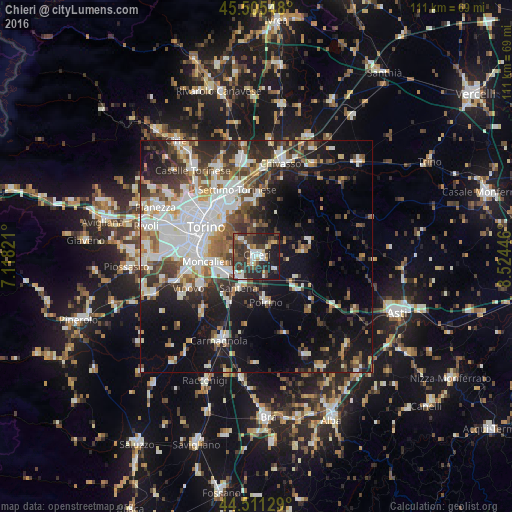
Analysis of Chieri night lights 2016
Square area 10x10 km:
 7.14%
7.14%90-99
10%80-89
2.22%70-79
5.08%60-69
4.13%50-59
3.65%40-49
14.29%30-39
13.97%20-29
25.08%10-19
14.44%0-9
0%Square area 50x50 km:
8.24%90-99
7.75%80-89
2.59%70-79
2.97%60-69
3.22%50-59
4.34%40-49
5.03%30-39
5.5%20-29
8.34%10-19
15.86%0-9
36.15%Clear (daylight) street map image can be seen on geolist.org.
Map coordinates:
45° 30' 19.7" North, 7° 7' 5.6" East
45° 0' 37.9" North, 7° 49' 16.8" East
44° 30' 40.6" North, 8° 31' 28.1" East
Some cities around Chieri sort by population:
• Moncalieri
11 km =6.8 mi,  263°
263°
• San Mauro Torinese
11.2 km =7 mi,  337°
337°
• Trofarello
6.6 km =4.1 mi,  241°
241°
• Santena
8.1 km =5 mi,  207°
207°
• Pino Torinese
4.7 km =2.9 mi,  312°
312°
• Poirino
10.2 km =6.3 mi,  169°
169°
• Cambiano
5.7 km =3.5 mi,  220°
220°
• Castiglione Torinese
12.1 km =7.5 mi,  354°
354°
3178818 (p: 32,169)
Sources (retrieved 2019-11-25):
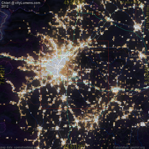
» Earth at Night: Flat Maps 2012, 2016