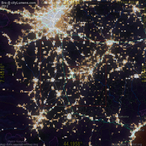
Bra night lights from space
Night Light of Bra (Piedmont) from space (Italy) Src. Average luminocity for 10x10km area is 41.0061% and for 50x50km: 18.528%.
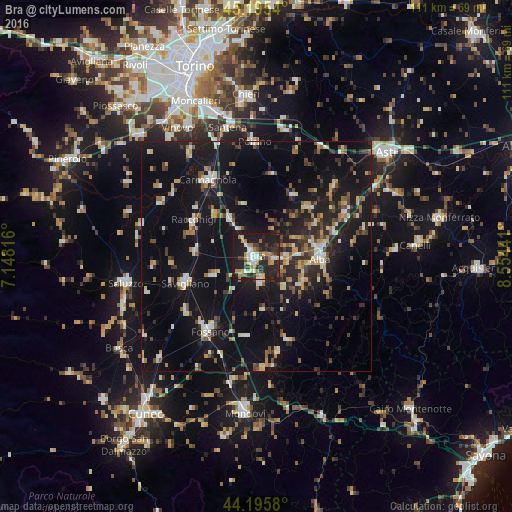
Analysis of Bra night lights 2016
Square area 10x10 km:
 5%
5%90-99
6.36%80-89
4.55%70-79
6.21%60-69
8.64%50-59
2.58%40-49
3.18%30-39
7.58%20-29
25.45%10-19
30.45%0-9
0%Square area 50x50 km:
1.39%90-99
2.52%80-89
2.06%70-79
1.8%60-69
2.19%50-59
2.13%40-49
2.6%30-39
2.8%20-29
5.9%10-19
23.12%0-9
53.49%Clear (daylight) street map image can be seen on geolist.org.
Map coordinates:
45° 11' 43.4" North, 7° 8' 53.4" East
44° 41' 51.9" North, 7° 51' 4.6" East
44° 11' 44.9" North, 8° 33' 15.9" East
Some cities around Bra sort by population:
• Alba
14.5 km =9 mi,  89°
89°
• Carmagnola
19.8 km =12.3 mi,  328°
328°
• Fossano
19.4 km =12.1 mi,  212°
212°
• Savigliano
16.3 km =10.1 mi,  250°
250°
• Racconigi
15.6 km =9.7 mi,  299°
299°
• Carignano
27.1 km =16.8 mi, 328°
• Poirino
24.8 km =15.4 mi,  358°
358°
• Sommariva del Bosco
10 km =6.2 mi, 326°
3181631 (p: 24,072)
Sources (retrieved 2019-11-25):
» Earth at Night: Flat Maps 2012, 2016