Bosa night lights from space
Night Light of Bosa (Sardinia) from space (Italy) Src. Average luminocity for 10x10km area is 11.7806% and for 50x50km: 2.107%.
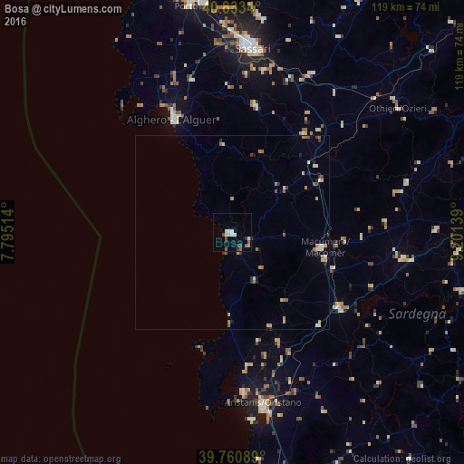
Analysis of Bosa night lights 2016
Square area 10x10 km:
 2.04%
2.04%90-99
2.55%80-89
0.68%70-79
0.68%60-69
0.68%50-59
2.72%40-49
1.53%30-39
1.53%20-29
1.53%10-19
0.17%0-9
85.88%Square area 50x50 km:
0.14%90-99
0.32%80-89
0.26%70-79
0.32%60-69
0.34%50-59
0.38%40-49
0.22%30-39
0.29%20-29
0.26%10-19
0.32%0-9
97.16%Clear (daylight) street map image can be seen on geolist.org.
Map coordinates:
40° 50' 0.2" North, 7° 47' 42.5" East
40° 17' 57.4" North, 8° 29' 53.8" East
39° 45' 39.2" North, 9° 12' 5" East
Some cities around Bosa sort by population:
• Sassari
47.7 km =29.6 mi,  5°
5°
• Alghero
32.7 km =20.3 mi,  332°
332°
• Oristano
44.7 km =27.8 mi,  169°
169°
• Macomer
23.2 km =14.4 mi,  100°
100°
• Li Punti-San Giovanni
51.6 km =32.1 mi,  359°
359°
• Ittiri
33.1 km =20.6 mi, 10°
• Cabras
41.3 km =25.7 mi,  175°
175°
• Ossi
42.5 km =26.4 mi, 10°
3181706 (p: 7,874)
Sources (retrieved 2019-11-25):
» Earth at Night: Flat Maps 2012, 2016