Li Punti-San Giovanni night lights from space
Night Light of Li Punti-San Giovanni (Sardinia) from space (Italy) Src. Average luminocity for 10x10km area is 35.1299% and for 50x50km: 8.1054%.
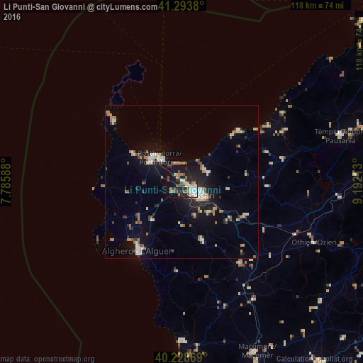
Analysis of Li Punti-San Giovanni night lights 2016
Square area 10x10 km:
 5.52%
5.52%90-99
5.36%80-89
1.95%70-79
3.57%60-69
5.52%50-59
7.95%40-49
5.19%30-39
2.92%20-29
12.99%10-19
36.69%0-9
12.34%Square area 50x50 km:
1.01%90-99
1.21%80-89
0.71%70-79
0.92%60-69
1.24%50-59
1.01%40-49
0.71%30-39
0.91%20-29
2.15%10-19
6.26%0-9
83.87%Clear (daylight) street map image can be seen on geolist.org.
Map coordinates:
41° 17' 37.7" North, 7° 47' 9.2" East
40° 45' 48.2" North, 8° 29' 20.4" East
40° 13' 43.3" North, 9° 11' 31.7" East
Some cities around Li Punti-San Giovanni sort by population:
• Sassari
7 km =4.3 mi,  126°
126°
• Alghero
26.8 km =16.7 mi,  212°
212°
• Porto Torres
10.5 km =6.5 mi,  318°
318°
• Sorso
8.3 km =5.2 mi,  61°
61°
• Ittiri
20.3 km =12.6 mi,  160°
160°
• Ozieri
47.6 km =29.6 mi,  114°
114°
• Sennori
9.2 km =5.7 mi,  72°
72°
• Ossi
13.2 km =8.2 mi,  138°
138°
3205826 (p: 9,681)
Sources (retrieved 2019-11-25):
» Earth at Night: Flat Maps 2012, 2016