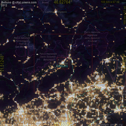
Belluno night lights from space
Night Light of Belluno (Veneto) from space (Italy) Src. Average luminocity for 10x10km area is 17.9901% and for 50x50km: 8.1649%.
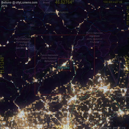
Analysis of Belluno night lights 2016
Square area 10x10 km:
 1.28%
1.28%90-99
3.55%80-89
2.27%70-79
1.99%60-69
0.99%50-59
2.98%40-49
1.85%30-39
1.14%20-29
3.84%10-19
13.49%0-9
66.62%Square area 50x50 km:
0.39%90-99
1%80-89
0.69%70-79
1.01%60-69
1.26%50-59
1.22%40-49
1.67%30-39
2.14%20-29
2.83%10-19
5.15%0-9
82.64%Clear (daylight) street map image can be seen on geolist.org.
Map coordinates:
46° 37' 39.5" North, 11° 30' 44.9" East
46° 8' 33.4" North, 12° 12' 56.2" East
45° 39' 11.8" North, 12° 55' 7.4" East
Some cities around Belluno sort by population:
• Vittorio Veneto
19.2 km =11.9 mi,  160°
160°
• Feltre
27.8 km =17.3 mi,  240°
240°
• Pieve di Soligo
27.4 km =17 mi,  187°
187°
• Ponte nelle Alpi
6.7 km =4.2 mi,  50°
50°
• Farra di Soligo
27.3 km =17 mi, 194°
• Caneva
26.4 km =16.4 mi,  136°
136°
• Sedico
10.3 km =6.4 mi,  246°
246°
• Ponte nelle Alpi-Polpet
7 km =4.3 mi,  43°
43°
3182210 (p: 25,064)
Sources (retrieved 2019-11-25):
» Earth at Night: Flat Maps 2012, 2016