Albino night lights from space
Night Light of Albino (Lombardy) from space (Italy) Src. Average luminocity for 10x10km area is 40.2714% and for 50x50km: 36.7164%.
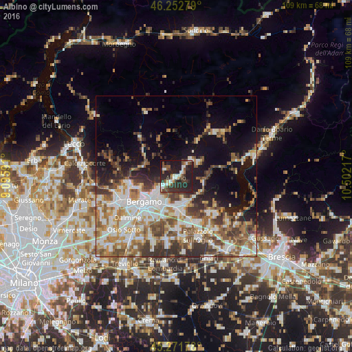
Analysis of Albino night lights 2016
Square area 10x10 km:
 7.94%
7.94%90-99
6.35%80-89
2.06%70-79
0.79%60-69
3.17%50-59
7.94%40-49
6.51%30-39
11.27%20-29
30.32%10-19
23.02%0-9
0.63%Square area 50x50 km:
7.48%90-99
7.98%80-89
3.33%70-79
3.9%60-69
6.07%50-59
5.94%40-49
5.34%30-39
6.09%20-29
6.23%10-19
11.85%0-9
35.79%Clear (daylight) street map image can be seen on geolist.org.
Map coordinates:
46° 15' 10" North, 9° 5' 45.3" East
45° 45' 52" North, 9° 47' 56.5" East
45° 16' 18.4" North, 10° 30' 7.8" East
Some cities around Albino sort by population:
• Alzano Lombardo
6.4 km =4 mi,  241°
241°
• Nembro
3.7 km =2.3 mi,  232°
232°
• Trescore Balneario
8.5 km =5.3 mi,  157°
157°
• Torre Boldone
8.8 km =5.5 mi, 233°
• Albano Sant'Alessandro
8.9 km =5.5 mi,  196°
196°
• Villa di Serio
6.8 km =4.2 mi, 226°
• Scanzo-Rosciate
7.8 km =4.8 mi,  219°
219°
• Ranica
8.1 km =5 mi, 235°
3183316 (p: 13,263)
Sources (retrieved 2019-11-25):
» Earth at Night: Flat Maps 2012, 2016