Albiate night lights from space
Night Light of Albiate (Lombardy) from space (Italy) Src. Average luminocity for 10x10km area is 92.2455% and for 50x50km: 72.6693%.
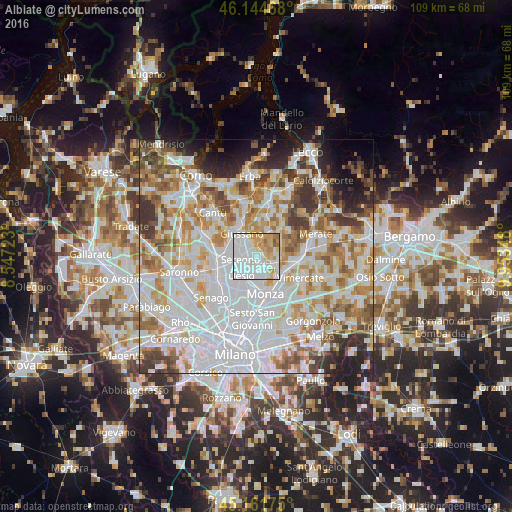
Analysis of Albiate night lights 2016
Square area 10x10 km:
 51.67%
90-99
18.03%80-89
11.21%70-79
13.33%60-69
3.64%50-59
1.97%40-49
0.15%30-39
0%20-29
0%10-19
0%0-9
0%Square area 50x50 km:
27.27%90-99
18.28%80-89
6.85%70-79
8.53%60-69
8.68%50-59
6.51%40-49
5.36%30-39
5.66%20-29
4.89%10-19
5.01%0-9
2.96%Clear (daylight) street map image can be seen on geolist.org.
Map coordinates:
46° 8' 40.8" North, 8° 32' 50" East
45° 39' 19.3" North, 9° 15' 1.3" East
45° 9' 42.3" North, 9° 57' 12.5" East
Some cities around Albiate sort by population:
• Seregno
3.5 km =2.2 mi,  260°
260°
• Lissone
4.9 km =3 mi,  189°
189°
• Carate Brianza
2.5 km =1.6 mi,  335°
335°
• Biassono
3.4 km =2.1 mi,  151°
151°
• Verano Brianza
4.2 km =2.6 mi,  331°
331°
• Lesmo
4.5 km =2.8 mi,  99°
99°
• Sovico
1.4 km =0.9 mi,  137°
137°
• Macherio
2.5 km =1.6 mi,  133°
133°
3183321 (p: 6,158)
Sources (retrieved 2019-11-25):
» Earth at Night: Flat Maps 2012, 2016