Najafābād night lights from space
Night Light of Najafābād (Isfahan) from space (Iran) Src. Average luminocity for 10x10km area is 83.2343% and for 50x50km: 42.4152%.
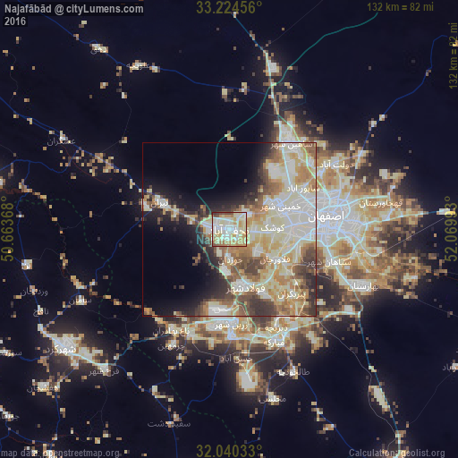
Analysis of Najafābād night lights 2016
Square area 10x10 km:
 16.96%
90-99
24.83%80-89
25.17%70-79
14.86%60-69
8.92%50-59
1.4%40-49
5.42%30-39
1.57%20-29
0.87%10-19
0%0-9
0%Square area 50x50 km:
7.11%90-99
10.84%80-89
8.94%70-79
5.79%60-69
5.41%50-59
5.01%40-49
4.78%30-39
4.91%20-29
5.04%10-19
8.28%0-9
33.88%Clear (daylight) street map image can be seen on geolist.org.
Map coordinates:
33° 13' 28.4" North, 50° 39' 49.2" East
32° 38' 3.8" North, 51° 22' 0.5" East
32° 2' 25.2" North, 52° 4' 11.7" East
Some cities around Najafābād sort by population:
• Isfahan
28.9 km =18 mi,  86°
86°
• Khomeynī Shahr
16.8 km =10.4 mi,  70°
70°
• Falāvarjān
16 km =9.9 mi,  123°
123°
• Rehnān
22.6 km =14 mi,  76°
76°
• Dorcheh Pīāz
17.8 km =11.1 mi,  96°
96°
• Kelīshād va Sūdarjān
17.7 km =11 mi, 121°
• Qahderījān
10.5 km =6.5 mi,  127°
127°
• Abrīsham
21.2 km =13.2 mi,  114°
114°
418606 (p: 223,450)
Sources (retrieved 2019-11-25):
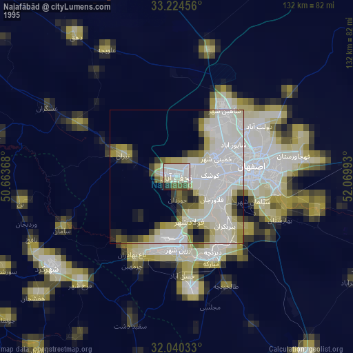
» NASA, Earths city lights 1995
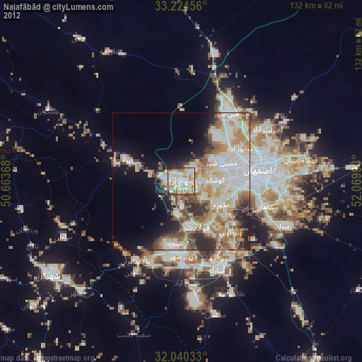
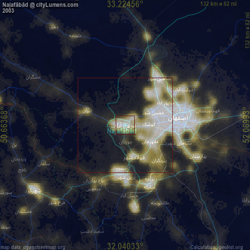
» NASA city lights 2003
» Earth at Night: Flat Maps 2012, 2016