Bīrjand night lights from space
Night Light of Bīrjand (Khorāsān-e Jonūbī) from space (Iran) Src. Average luminocity for 10x10km area is 71.0385% and for 50x50km: 7.5417%.
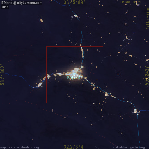
Analysis of Bīrjand night lights 2016
Square area 10x10 km:
 17.22%
90-99
24.36%80-89
11.36%70-79
4.58%60-69
3.3%50-59
8.79%40-49
10.26%30-39
7.33%20-29
12.45%10-19
0.37%0-9
0%Square area 50x50 km:
0.81%90-99
1.46%80-89
1.24%70-79
0.55%60-69
0.41%50-59
1.06%40-49
1.22%30-39
1.39%20-29
2.26%10-19
4.96%0-9
84.64%Clear (daylight) street map image can be seen on geolist.org.
Map coordinates:
33° 27' 17.6" North, 58° 31' 4.9" East
32° 51' 58.6" North, 59° 13' 16.1" East
32° 16' 25.5" North, 59° 55' 27.4" East
Some cities around Bīrjand sort by population:
• Torbat-e Ḩeydarīyeh
267.7 km =166.3 mi,  359°
359°
• Tabas
228.5 km =142 mi,  290°
290°
• Gonābād
172.6 km =107.2 mi,  343°
343°
• Qā’en
95.7 km =59.5 mi, 357°
• Tāybād
253 km =157.2 mi,  34°
34°
• Kafir Qala, AF
263 km =163.4 mi,  40°
40°
• Kushk, AF
258.9 km =160.9 mi,  79°
79°
• Anār Darah, AF
227.7 km =141.5 mi,  93°
93°
140463 (p: 196,982)
Sources (retrieved 2019-11-25):
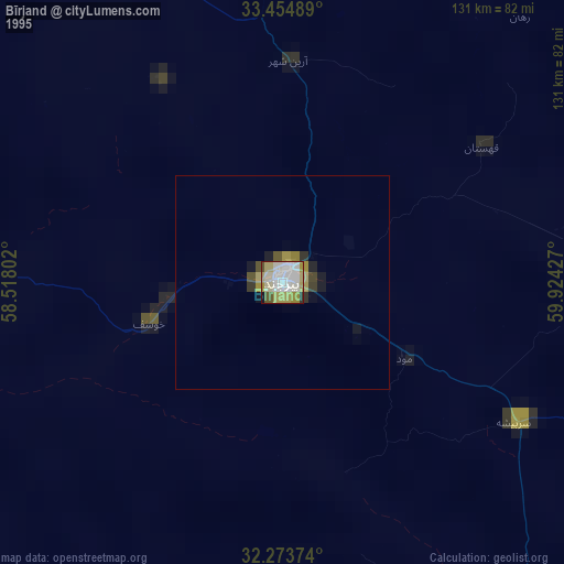
» NASA, Earths city lights 1995
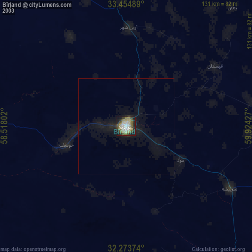
» NASA city lights 2003
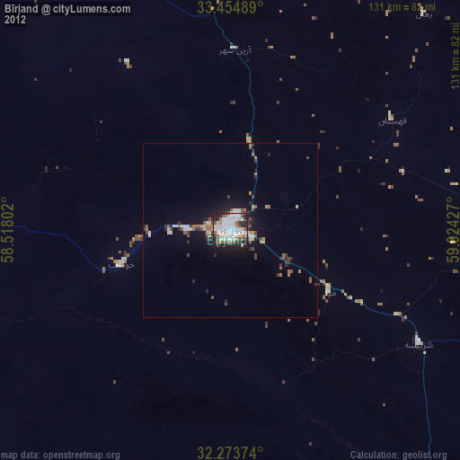
» Earth at Night: Flat Maps 2012, 2016