Udaipur night lights from space
Night Light of Udaipur (Tripura) from space (India) Src. Average luminocity for 10x10km area is 47.0476% and for 50x50km: 14.1907%.
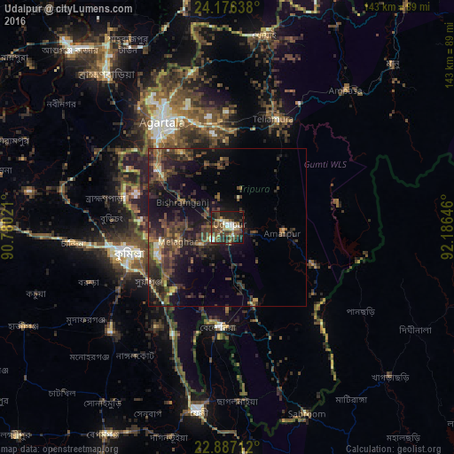
Analysis of Udaipur night lights 2016
Square area 10x10 km:
 5.36%
5.36%90-99
6.75%80-89
4.76%70-79
5.75%60-69
5.36%50-59
10.32%40-49
16.67%30-39
14.68%20-29
11.11%10-19
18.65%0-9
0.6%Square area 50x50 km:
0.35%90-99
0.9%80-89
0.87%70-79
1.25%60-69
1.69%50-59
2.33%40-49
5.85%30-39
5.62%20-29
7.22%10-19
11.71%0-9
62.21%Clear (daylight) street map image can be seen on geolist.org.
Map coordinates:
24° 10' 35" North, 90° 46' 48.8" East
23° 31' 60" North, 91° 28' 60" East
22° 53' 13.6" North, 92° 11' 11.3" East
Some cities around Udaipur sort by population:
• Comilla, BD
31.4 km =19.5 mi,  255°
255°
• Agartala
39.5 km =24.5 mi,  328°
328°
• Lākshām, BD
49.3 km =30.6 mi,  228°
228°
• Barjala
16 km =9.9 mi,  306°
306°
• Belonia
31.4 km =19.5 mi,  185°
185°
• Amarpur
17.9 km =11.1 mi,  92°
92°
• Rānīr Bāzār
35.6 km =22.1 mi,  340°
340°
• Sonāmura
23.1 km =14.4 mi,  253°
253°
1253987 (p: 23,290)
Sources (retrieved 2019-11-25):
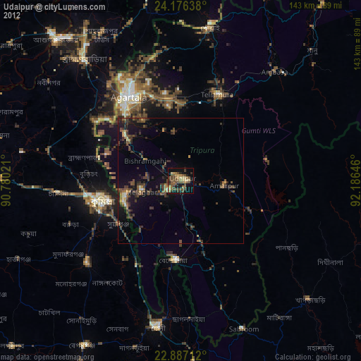
» Earth at Night: Flat Maps 2012, 2016