Talipparamba night lights from space
Night Light of Talipparamba (Kerala) from space (India) Src. Average luminocity for 10x10km area is 4.9194% and for 50x50km: 2.5277%.
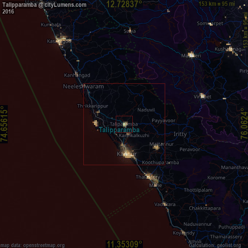
Analysis of Talipparamba night lights 2016
Square area 10x10 km:
 0%
0%90-99
0%80-89
0.83%70-79
0.83%60-69
0.83%50-59
0.83%40-49
1.65%30-39
2.48%20-29
0%10-19
0.83%0-9
91.74%Square area 50x50 km:
0%90-99
0.05%80-89
0.6%70-79
0.37%60-69
0.22%50-59
0.34%40-49
0.69%30-39
0.78%20-29
0.85%10-19
1.34%0-9
94.76%Clear (daylight) street map image can be seen on geolist.org.
Map coordinates:
12° 43' 42.1" North, 74° 39' 22.1" East
12° 2' 29.8" North, 75° 21' 33.4" East
11° 21' 11.1" North, 76° 3' 44.6" East
Some cities around Talipparamba sort by population:
• Payyannūr
18 km =11.2 mi,  288°
288°
• Kannur
19.4 km =12.1 mi,  180°
180°
• Mattanur
26.2 km =16.3 mi,  118°
118°
• Pāppinisshēri
9.7 km =6 mi,  192°
192°
• Dharmadam
31.7 km =19.7 mi,  158°
158°
• Nīlēshwar
34.4 km =21.4 mi,  314°
314°
• Muluppilagadu
28.9 km =18 mi, 159°
• Azhikkal
14.1 km =8.8 mi, 185°
1255121 (p: 69,878)
Sources (retrieved 2019-11-25):
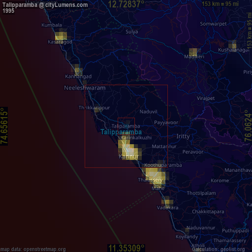
» NASA, Earths city lights 1995
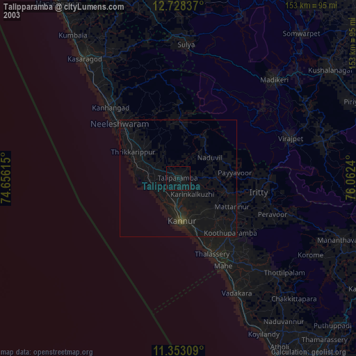
» NASA city lights 2003
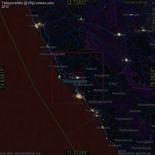
» Earth at Night: Flat Maps 2012, 2016