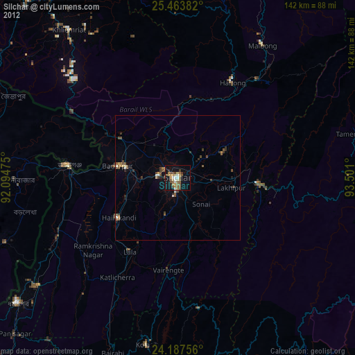
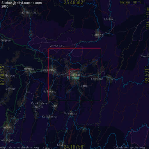
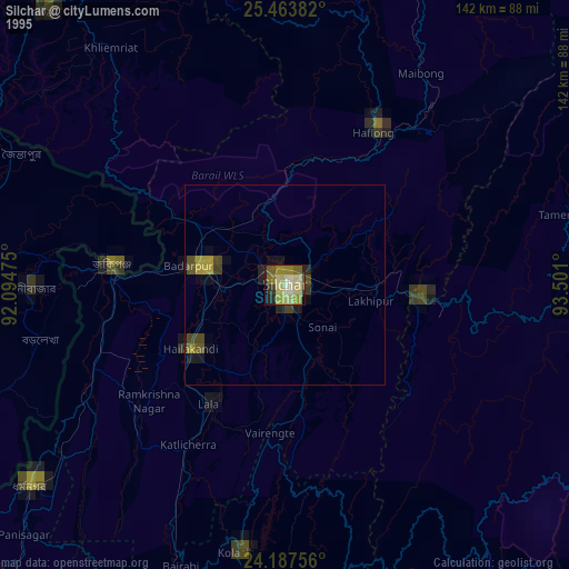
Silchar night lights from space
Night Light of Silchar (Assam) from space (India) Src. Average luminocity for 10x10km area is 36.4716% and for 50x50km: 3.8601%.
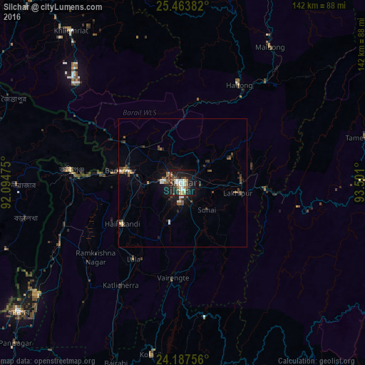
Analysis of Silchar night lights 2016
Square area 10x10 km:
 2.84%
2.84%90-99
9.66%80-89
5.68%70-79
1.89%60-69
3.98%50-59
4.92%40-49
7.77%30-39
3.79%20-29
10.42%10-19
34.09%0-9
14.96%Square area 50x50 km:
0.22%90-99
0.69%80-89
0.38%70-79
0.21%60-69
0.49%50-59
0.69%40-49
1%30-39
0.49%20-29
1.04%10-19
2.91%0-9
91.87%Clear (daylight) street map image can be seen on geolist.org.
Map coordinates:
25° 27' 49.8" North, 92° 5' 41.1" East
24° 49' 38.4" North, 92° 47' 52.3" East
24° 11' 15.2" North, 93° 30' 3.6" East
Some cities around Silchar sort by population:
• Karīmganj
44.9 km =27.9 mi,  275°
275°
• Hāflong
43.6 km =27.1 mi,  30°
30°
• Hailākāndi
28.7 km =17.8 mi,  236°
236°
• Lakhipur
21.7 km =13.5 mi,  100°
100°
• Badarpur
20.9 km =13 mi, 282°
• Lāla
35.5 km =22.1 mi,  211°
211°
• Maibong
62.9 km =39.1 mi, 33°
• Mahur
50.7 km =31.5 mi,  38°
38°
1256287 (p: 152,393)
Sources (retrieved 2019-11-25):
» NASA, Earths city lights 1995
» NASA city lights 2003
» Earth at Night: Flat Maps 2012, 2016