Saint Thomas Mount night lights from space
Night Light of Saint Thomas Mount (Tamil Nadu) from space (India) Src. Average luminocity for 10x10km area is 99.4545% and for 50x50km: 61.0636%.
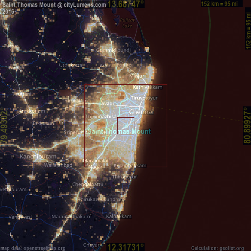
Analysis of Saint Thomas Mount night lights 2016
Square area 10x10 km:
 74.68%
90-99
24.89%80-89
0.43%70-79
0%60-69
0%50-59
0%40-49
0%30-39
0%20-29
0%10-19
0%0-9
0%Square area 50x50 km:
16.31%90-99
16.58%80-89
15.75%70-79
5.6%60-69
7.41%50-59
6.02%40-49
2.68%30-39
2.18%20-29
2.83%10-19
4.11%0-9
20.52%Clear (daylight) street map image can be seen on geolist.org.
Map coordinates:
13° 41' 14.9" North, 79° 29' 34.9" East
13° 0' 12" North, 80° 11' 46.1" East
12° 19' 2.3" North, 80° 53' 57.4" East
Some cities around Saint Thomas Mount sort by population:
• Pallāvaram
6.3 km =3.9 mi,  231°
231°
• Alandur
1.1 km =0.7 mi,  94°
94°
• Porur
5.5 km =3.4 mi,  311°
311°
• Perungudi
6.8 km =4.2 mi,  134°
134°
• Madipakkam
4.6 km =2.9 mi,  176°
176°
• Palavakkam
8.6 km =5.3 mi, 129°
• Gāndhī Nagar
6.3 km =3.9 mi, 86°
• Manappakkam
3.1 km =1.9 mi,  285°
285°
1257749 (p: 43,223)
Sources (retrieved 2019-11-25):
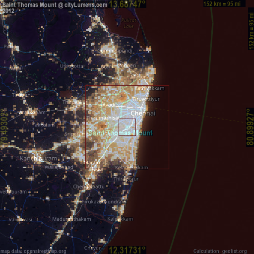
» Earth at Night: Flat Maps 2012, 2016