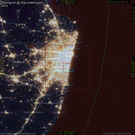
Perungudi night lights from space
Night Light of Perungudi (Tamil Nadu) from space (India) Src. Average luminocity for 10x10km area is 87.2186% and for 50x50km: 52.3624%.
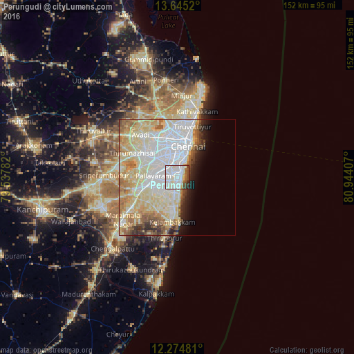
Analysis of Perungudi night lights 2016
Square area 10x10 km:
 38.74%
90-99
34.42%80-89
6.28%70-79
0.22%60-69
2.38%50-59
5.84%40-49
7.79%30-39
2.6%20-29
1.73%10-19
0%0-9
0%Square area 50x50 km:
15.79%90-99
14.89%80-89
12.8%70-79
4.14%60-69
4.79%50-59
3.84%40-49
2.38%30-39
2.26%20-29
2.83%10-19
3.7%0-9
32.59%Clear (daylight) street map image can be seen on geolist.org.
Map coordinates:
13° 38' 42.7" North, 79° 32' 16.2" East
12° 57' 39.4" North, 80° 14' 27.4" East
12° 16' 29.3" North, 80° 56' 38.7" East
Some cities around Perungudi sort by population:
• Alandur
6 km =3.7 mi,  320°
320°
• Saint Thomas Mount
6.8 km =4.2 mi,  314°
314°
• Injambakkam
5 km =3.1 mi,  170°
170°
• Madipakkam
4.6 km =2.9 mi,  271°
271°
• Neelankarai
2.4 km =1.5 mi,  122°
122°
• Palavakkam
1.9 km =1.2 mi, 115°
• Gāndhī Nagar
5.3 km =3.3 mi,  15°
15°
• Manappakkam
9.6 km =6 mi, 305°
1465828 (p: 30,363)
Sources (retrieved 2019-11-25):
» Earth at Night: Flat Maps 2012, 2016