Nūzvīd night lights from space
Night Light of Nūzvīd (Andhra Pradesh) from space (India) Src. Average luminocity for 10x10km area is 18.2424% and for 50x50km: 7.3172%.
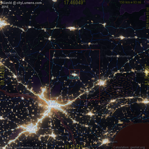
Analysis of Nūzvīd night lights 2016
Square area 10x10 km:
 0.65%
0.65%90-99
5.41%80-89
0.87%70-79
1.52%60-69
2.38%50-59
0.87%40-49
3.46%30-39
5.41%20-29
2.81%10-19
5.84%0-9
70.78%Square area 50x50 km:
0.03%90-99
0.52%80-89
0.3%70-79
0.57%60-69
0.78%50-59
1.59%40-49
1.72%30-39
2.7%20-29
3.7%10-19
7.34%0-9
80.75%Clear (daylight) street map image can be seen on geolist.org.
Map coordinates:
17° 27' 37.8" North, 80° 8' 34.1" East
16° 47' 18.7" North, 80° 50' 45.3" East
16° 6' 51.2" North, 81° 32' 56.6" East
Some cities around Nūzvīd sort by population:
• Vijayawada
37.8 km =23.5 mi,  214°
214°
• Ellore
28.8 km =17.9 mi,  106°
106°
• Gudivāda
42.4 km =26.3 mi,  157°
157°
• Kondapalle
37.4 km =23.2 mi,  239°
239°
• Tādepalle
42.9 km =26.7 mi,  217°
217°
• Yanamalakuduru
38.7 km =24 mi, 209°
• Gannavaram
27.9 km =17.3 mi,  189°
189°
• Kankipādu
40.2 km =25 mi, 192°
1261110 (p: 53,391)
Sources (retrieved 2019-11-25):
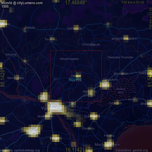
» NASA, Earths city lights 1995
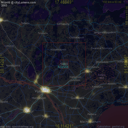
» NASA city lights 2003
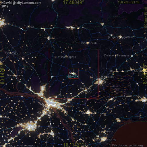
» Earth at Night: Flat Maps 2012, 2016