Yanamalakuduru night lights from space
Night Light of Yanamalakuduru (Andhra Pradesh) from space (India) Src. Average luminocity for 10x10km area is 78.5888% and for 50x50km: 34.2572%.
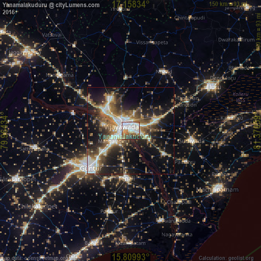
Analysis of Yanamalakuduru night lights 2016
Square area 10x10 km:
 27.89%
90-99
26.65%80-89
5.17%70-79
7.85%60-69
6.61%50-59
7.44%40-49
4.75%30-39
8.06%20-29
5.58%10-19
0%0-9
0%Square area 50x50 km:
3.55%90-99
7.9%80-89
3.48%70-79
3.16%60-69
5.29%50-59
6.09%40-49
6.33%30-39
6.61%20-29
9.98%10-19
17.78%0-9
29.82%Clear (daylight) street map image can be seen on geolist.org.
Map coordinates:
17° 9' 30" North, 79° 57' 51.6" East
16° 29' 7.1" North, 80° 40' 2.9" East
15° 48' 35.7" North, 81° 22' 14.1" East
Some cities around Yanamalakuduru sort by population:
• Vijayawada
3.3 km =2.1 mi,  317°
317°
• Guntur
30.5 km =19 mi,  227°
227°
• Mangalagiri
12.2 km =7.6 mi,  240°
240°
• Kondapalle
20 km =12.4 mi, 318°
• Vuyyūru
23.2 km =14.4 mi,  125°
125°
• Tādepalle
7.2 km =4.5 mi,  268°
268°
• Gannavaram
15.6 km =9.7 mi,  66°
66°
• Kankipādu
12 km =7.5 mi,  117°
117°
7302853 (p: 30,000)
Sources (retrieved 2019-11-25):
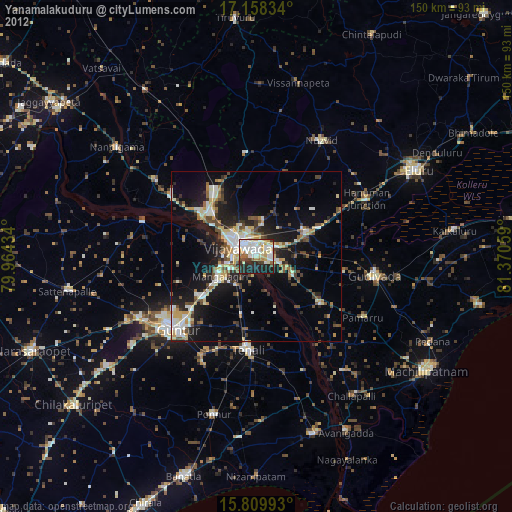
» Earth at Night: Flat Maps 2012, 2016