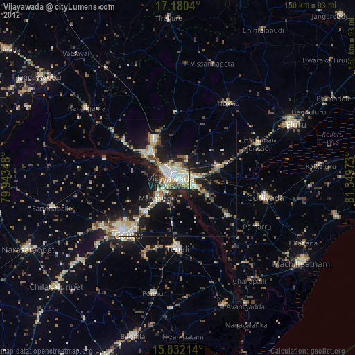
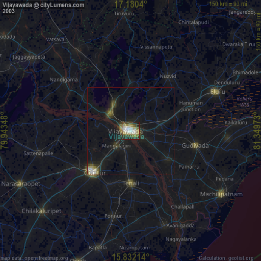
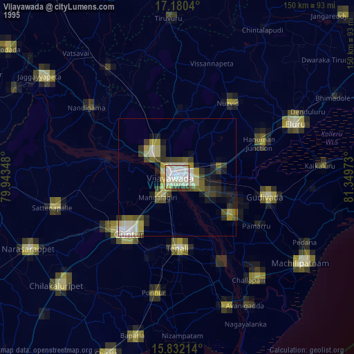
Vijayawada night lights from space
Night Light of Vijayawada (Andhra Pradesh) from space (India) Src. Average luminocity for 10x10km area is 91.2376% and for 50x50km: 34.1386%.
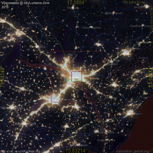
Analysis of Vijayawada night lights 2016
Square area 10x10 km:
 35.12%
90-99
39.26%80-89
6.4%70-79
7.44%60-69
6.4%50-59
4.13%40-49
1.03%30-39
0.21%20-29
0%10-19
0%0-9
0%Square area 50x50 km:
3.73%90-99
7.97%80-89
3.6%70-79
3.14%60-69
5.14%50-59
5.94%40-49
6.14%30-39
6.4%20-29
9.68%10-19
17.44%0-9
30.81%Clear (daylight) street map image can be seen on geolist.org.
Map coordinates:
17° 10' 49.4" North, 79° 56' 36.5" East
16° 30' 26.8" North, 80° 38' 47.8" East
15° 49' 55.7" North, 81° 20' 59" East
Some cities around Vijayawada sort by population:
• Guntur
30.7 km =19.1 mi,  221°
221°
• Mangalagiri
11.9 km =7.4 mi, 224°
• Kondapalle
16.7 km =10.4 mi,  318°
318°
• Vuyyūru
26.5 km =16.5 mi,  127°
127°
• Tādepalle
5.6 km =3.5 mi,  241°
241°
• Yanamalakuduru
3.3 km =2.1 mi,  137°
137°
• Gannavaram
17 km =10.6 mi,  77°
77°
• Kankipādu
15.2 km =9.4 mi,  121°
121°
1253184 (p: 874,587)
Sources (retrieved 2019-11-25):
» NASA, Earths city lights 1995
» NASA city lights 2003
» Earth at Night: Flat Maps 2012, 2016