Nashik night lights from space
Night Light of Nashik (Maharashtra) from space (India) Src. Average luminocity for 10x10km area is 97.1627% and for 50x50km: 29.5091%.
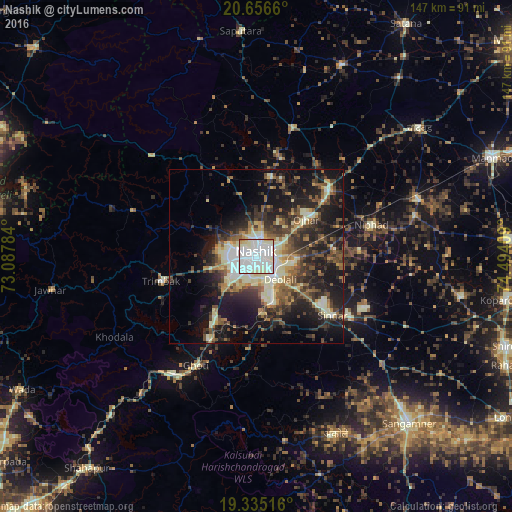
Analysis of Nashik night lights 2016
Square area 10x10 km:
 50.2%
50.2%90-99
43.85%80-89
3.17%70-79
1.39%60-69
1.39%50-59
0%40-49
0%30-39
0%20-29
0%10-19
0%0-9
0%Square area 50x50 km:
3.3%90-99
7.54%80-89
2.79%70-79
2.61%60-69
3.33%50-59
4.87%40-49
5.2%30-39
5.9%20-29
9.48%10-19
17.86%0-9
37.13%Clear (daylight) street map image can be seen on geolist.org.
Map coordinates:
20° 39' 23.8" North, 73° 5' 16.2" East
19° 59' 50.2" North, 73° 47' 27.5" East
19° 20' 6.6" North, 74° 29' 38.7" East
Some cities around Nashik sort by population:
• Deolāli
7.5 km =4.7 mi,  142°
142°
• Ozar
18 km =11.2 mi,  52°
52°
• Igatpuri
41.2 km =25.6 mi,  215°
215°
• Sinnar
27.5 km =17.1 mi,  127°
127°
• Ghoti Budrukh
35.6 km =22.1 mi,  208°
208°
• Lāsalgaon
49.6 km =30.8 mi,  70°
70°
• Jawhār
59.7 km =37.1 mi,  260°
260°
• Trimbak
28.3 km =17.6 mi, 255°
1261731 (p: 1,289,497)
Sources (retrieved 2019-11-25):
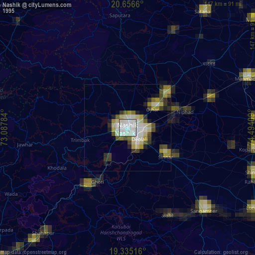
» NASA, Earths city lights 1995
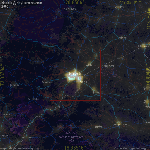
» NASA city lights 2003
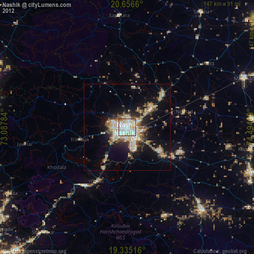
» Earth at Night: Flat Maps 2012, 2016