Morsi night lights from space
Night Light of Morsi (Maharashtra) from space (India) Src. Average luminocity for 10x10km area is 9.0701% and for 50x50km: 1.5576%.
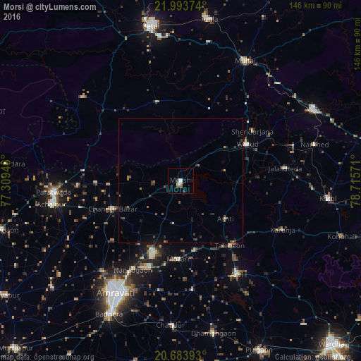
Analysis of Morsi night lights 2016
Square area 10x10 km:
 2.08%
2.08%90-99
1.7%80-89
0.19%70-79
1.33%60-69
0.76%50-59
1.52%40-49
0%30-39
1.52%20-29
1.14%10-19
0%0-9
89.77%Square area 50x50 km:
0.09%90-99
0.1%80-89
0.04%70-79
0.15%60-69
0.29%50-59
0.34%40-49
0.29%30-39
0.41%20-29
0.49%10-19
0.42%0-9
97.38%Clear (daylight) street map image can be seen on geolist.org.
Map coordinates:
21° 59' 37.5" North, 77° 18' 34.1" East
21° 20' 25.1" North, 78° 0' 45.3" East
20° 41' 2.1" North, 78° 42' 56.6" East
Some cities around Morsi sort by population:
• Amrāvati
52.8 km =32.8 mi,  211°
211°
• Achalpur
52.9 km =32.9 mi,  259°
259°
• Warud
30.3 km =18.8 mi,  61°
61°
• Ārvi
44.4 km =27.6 mi,  149°
149°
• Multai
54.5 km =33.9 mi,  27°
27°
• Chāndūr Bāzār
29.7 km =18.5 mi,  247°
247°
• Bhainsdehi
52.1 km =32.4 mi,  310°
310°
• Mowād
47.5 km =29.5 mi,  73°
73°
1262740 (p: 35,554)
Sources (retrieved 2019-11-25):
» Earth at Night: Flat Maps 2012, 2016