Karīmnagar night lights from space
Night Light of Karīmnagar (Telangana) from space (India) Src. Average luminocity for 10x10km area is 67.438% and for 50x50km: 13.137%.
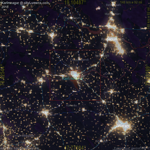
Analysis of Karīmnagar night lights 2016
Square area 10x10 km:
 17.15%
90-99
20.25%80-89
9.92%70-79
7.02%60-69
5.79%50-59
7.44%40-49
4.55%30-39
7.44%20-29
16.74%10-19
3.72%0-9
0%Square area 50x50 km:
0.87%90-99
1.35%80-89
0.95%70-79
1.06%60-69
1.62%50-59
2.49%40-49
2.74%30-39
3.53%20-29
5.11%10-19
8.69%0-9
71.58%Clear (daylight) street map image can be seen on geolist.org.
Map coordinates:
19° 6' 17.5" North, 78° 25' 31.6" East
18° 26' 20.9" North, 79° 7' 42.8" East
17° 46' 15" North, 79° 49' 54.1" East
Some cities around Karīmnagar sort by population:
• Ramagundam
50.6 km =31.4 mi,  46°
46°
• Jagtiāl
45.4 km =28.2 mi,  330°
330°
• Sirsilla
34 km =21.1 mi,  260°
260°
• Siddipet
47.5 km =29.5 mi,  218°
218°
• Peddapalli
32.4 km =20.1 mi, 53°
• Vemalwāda
27.5 km =17.1 mi,  276°
276°
• Lakshettipet
48.4 km =30.1 mi,  11°
11°
• Kottapalli
7.2 km =4.5 mi, 329°
1267755 (p: 228,745)
Sources (retrieved 2019-11-25):
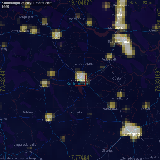
» NASA, Earths city lights 1995
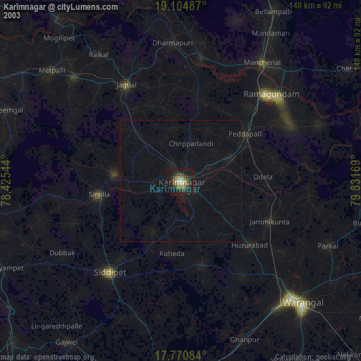
» NASA city lights 2003
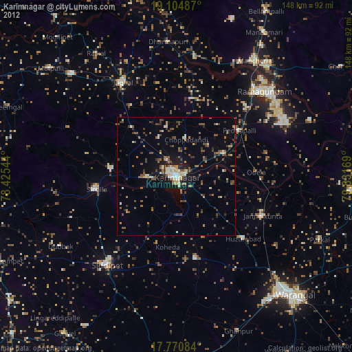
» Earth at Night: Flat Maps 2012, 2016