Hassan night lights from space
Night Light of Hassan (Karnataka) from space (India) Src. Average luminocity for 10x10km area is 60.2814% and for 50x50km: 6.3879%.
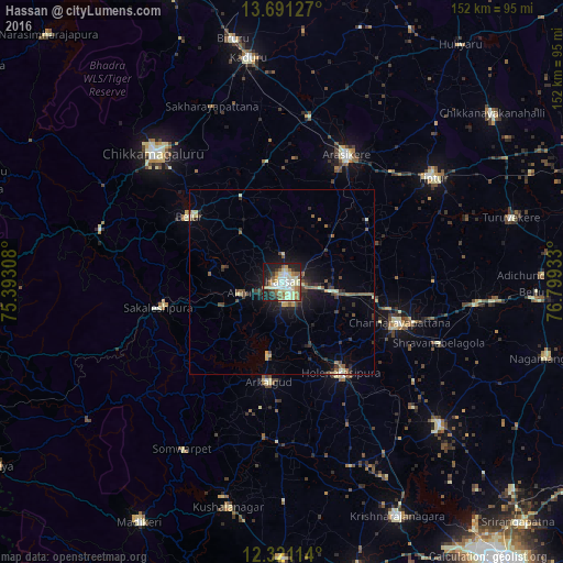
Analysis of Hassan night lights 2016
Square area 10x10 km:
 9.31%
9.31%90-99
17.75%80-89
15.15%70-79
1.95%60-69
9.96%50-59
8.87%40-49
1.52%30-39
6.28%20-29
12.34%10-19
16.23%0-9
0.65%Square area 50x50 km:
0.44%90-99
1.01%80-89
1.14%70-79
0.28%60-69
0.62%50-59
1.39%40-49
0.82%30-39
1.1%20-29
1.91%10-19
4.21%0-9
87.08%Clear (daylight) street map image can be seen on geolist.org.
Map coordinates:
13° 41' 28.6" North, 75° 23' 35.1" East
13° 0' 25.7" North, 76° 5' 46.3" East
12° 19' 16.1" North, 76° 47' 57.6" East
Some cities around Hassan sort by population:
• Arsikere
38.4 km =23.9 mi,  27°
27°
• Channarāyapatna
33.5 km =20.8 mi,  109°
109°
• Hole Narsipur
29.3 km =18.2 mi,  146°
146°
• Sakleshpur
34.5 km =21.4 mi,  257°
257°
• Belūr
30.6 km =19 mi,  305°
305°
• Arkalgūd
27.6 km =17.1 mi,  188°
188°
• Alūr
11.9 km =7.4 mi,  254°
254°
• Gorūr
20.8 km =12.9 mi, 189°
1270239 (p: 128,531)
Sources (retrieved 2019-11-25):
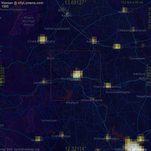
» NASA, Earths city lights 1995
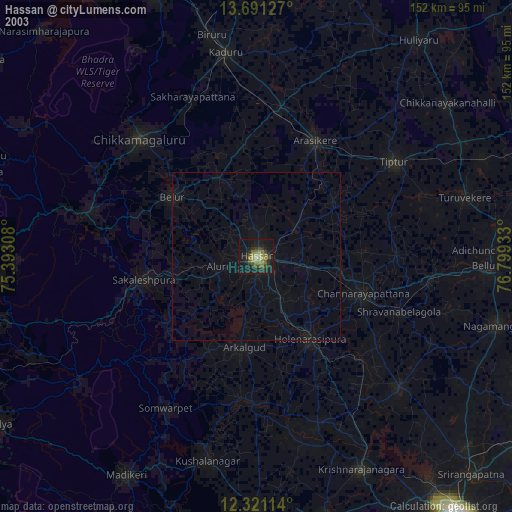
» NASA city lights 2003
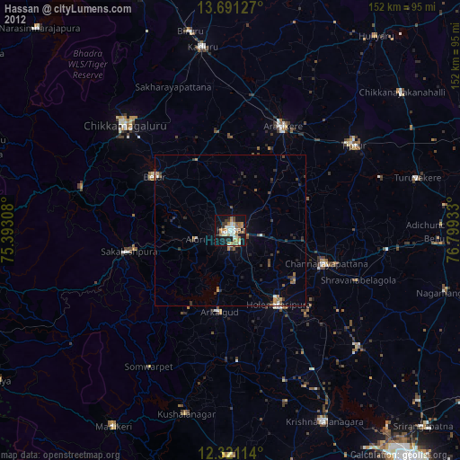
» Earth at Night: Flat Maps 2012, 2016