Fatehpur night lights from space
Night Light of Fatehpur (Rajasthan) from space (India) Src. Average luminocity for 10x10km area is 14.0587% and for 50x50km: 2.1491%.

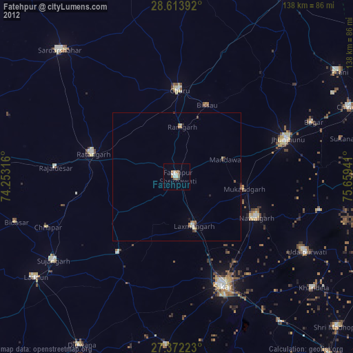
Analysis of Fatehpur night lights 2016
Square area 10x10 km:
 1.7%
1.7%90-99
2.84%80-89
3.6%70-79
1.52%60-69
0.95%50-59
0.19%40-49
1.33%30-39
1.7%20-29
0.57%10-19
0.76%0-9
84.85%Square area 50x50 km:
0.2%90-99
0.29%80-89
0.4%70-79
0.17%60-69
0.18%50-59
0.2%40-49
0.24%30-39
0.4%20-29
0.55%10-19
0.73%0-9
96.63%Clear (daylight) street map image can be seen on geolist.org.
Map coordinates:
28° 36' 50.1" North, 74° 15' 11.4" East
27° 59' 41.5" North, 74° 57' 22.6" East
27° 22' 20" North, 75° 39' 33.9" East
Some cities around Fatehpur sort by population:
• Sīkar
46.2 km =28.7 mi,  157°
157°
• Jhunjhunūn
45.7 km =28.4 mi,  71°
71°
• Chūru
34.4 km =21.4 mi,  1°
1°
• Ratangarh
34.5 km =21.4 mi,  286°
286°
• Nawalgarh
35 km =21.7 mi,  117°
117°
• Lachhmangarh Sīkar
20.4 km =12.7 mi, 159°
• Bissāu
30.5 km =19 mi,  22°
22°
• Bhuma
23.6 km =14.7 mi,  185°
185°
1271910 (p: 83,170)
Sources (retrieved 2019-11-25):
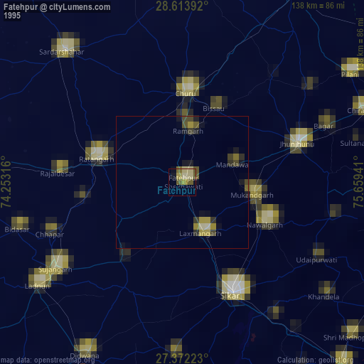
» NASA, Earths city lights 1995
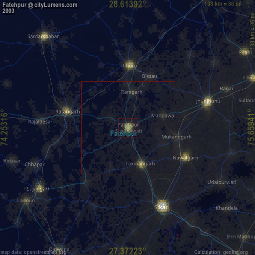
» NASA city lights 2003
» Earth at Night: Flat Maps 2012, 2016