Daudnagar night lights from space
Night Light of Daudnagar (Bihar) from space (India) Src. Average luminocity for 10x10km area is 30.8977% and for 50x50km: 25.25%.
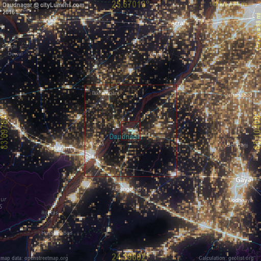
Analysis of Daudnagar night lights 2016
Square area 10x10 km:
 3.03%
3.03%90-99
3.79%80-89
2.65%70-79
1.89%60-69
1.52%50-59
7.58%40-49
6.06%30-39
6.82%20-29
11.74%10-19
52.46%0-9
2.46%Square area 50x50 km:
1.34%90-99
2.29%80-89
1.68%70-79
2.15%60-69
2.62%50-59
5.09%40-49
5.97%30-39
9.13%20-29
14.51%10-19
27.42%0-9
27.79%Clear (daylight) street map image can be seen on geolist.org.
Map coordinates:
25° 40' 12.5" North, 83° 41' 52.2" East
25° 2' 5" North, 84° 24' 3.4" East
24° 23' 45.7" North, 85° 6' 14.7" East
Some cities around Daudnagar sort by population:
• Dehri
26.5 km =16.5 mi,  236°
236°
• Aurangābād
31.5 km =19.6 mi,  184°
184°
• Bikramganj
24.5 km =15.2 mi,  323°
323°
• Piro
33.1 km =20.6 mi,  0°
0°
• Rafiganj
33.7 km =20.9 mi,  135°
135°
• Nāsriganj
7.5 km =4.7 mi,  284°
284°
• Tekāri
45.7 km =28.4 mi,  102°
102°
• Koāth
35.4 km =22 mi,  336°
336°
1273390 (p: 41,236)
Sources (retrieved 2019-11-25):
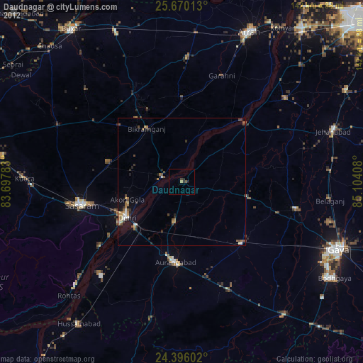
» Earth at Night: Flat Maps 2012, 2016