Challakere night lights from space
Night Light of Challakere (Karnataka) from space (India) Src. Average luminocity for 10x10km area is 34.7706% and for 50x50km: 5.7663%.
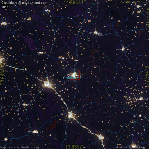
Analysis of Challakere night lights 2016
Square area 10x10 km:
 3.25%
3.25%90-99
9.96%80-89
1.95%70-79
6.06%60-69
2.16%50-59
5.41%40-49
3.68%30-39
4.55%20-29
8.87%10-19
40.48%0-9
13.64%Square area 50x50 km:
0.16%90-99
0.72%80-89
0.51%70-79
0.46%60-69
0.74%50-59
1.31%40-49
0.95%30-39
1.75%20-29
1.69%10-19
4.05%0-9
87.66%Clear (daylight) street map image can be seen on geolist.org.
Map coordinates:
14° 59' 53.7" North, 75° 56' 54.7" East
14° 19' 4.8" North, 76° 39' 5.9" East
13° 38' 8.5" North, 77° 21' 17.2" East
Some cities around Challakere sort by population:
• Chitradurga
29.1 km =18.1 mi,  248°
248°
• Rāyadrug
47.6 km =29.6 mi,  26°
26°
• Hiriyūr
41.7 km =25.9 mi,  185°
185°
• Kalyandurg
55 km =34.2 mi,  62°
62°
• Jagalūr
40.4 km =25.1 mi,  303°
303°
• Holalkere
58.9 km =36.6 mi,  238°
238°
• Hosakote
55.9 km =34.7 mi,  94°
94°
• Māyakonda
61.3 km =38.1 mi,  266°
266°
1274862 (p: 53,506)
Sources (retrieved 2019-11-25):
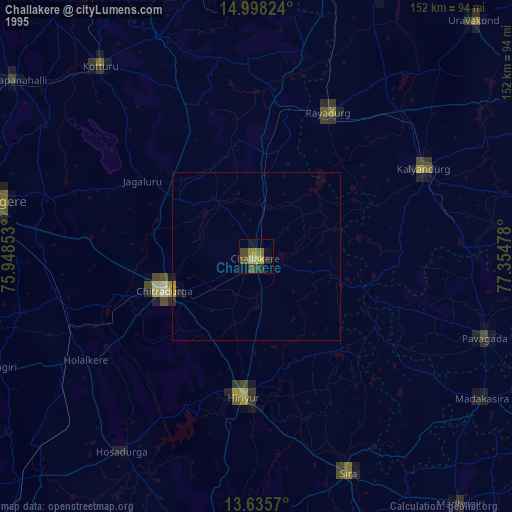
» NASA, Earths city lights 1995
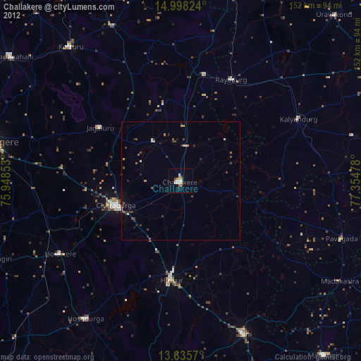
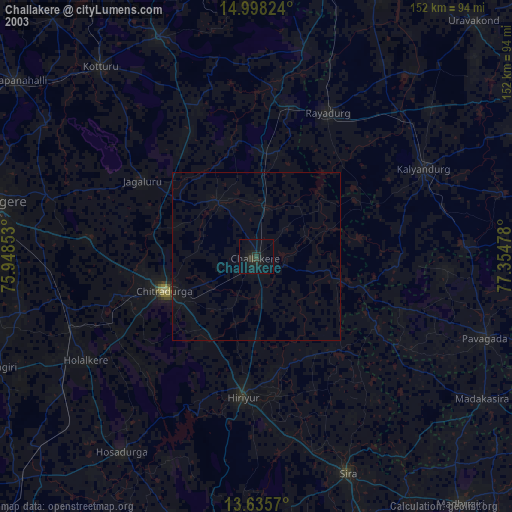
» NASA city lights 2003
» Earth at Night: Flat Maps 2012, 2016