Bengaluru night lights from space
Night Light of Bengaluru (Karnataka) from space (India) Src. Average luminocity for 10x10km area is 99.9957% and for 50x50km: 84.9482%.
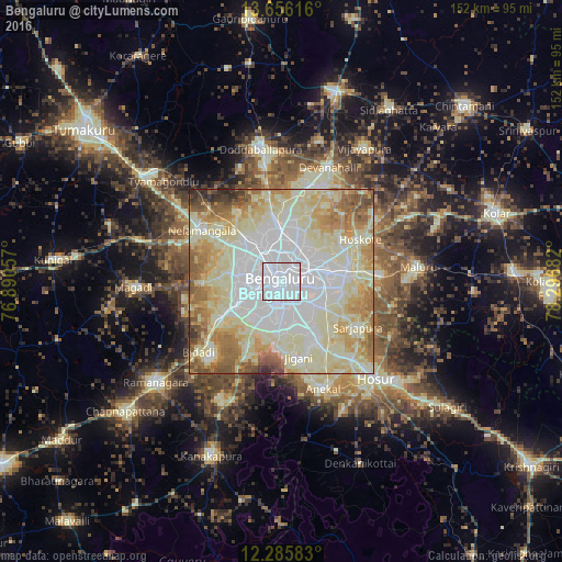
Analysis of Bengaluru night lights 2016
Square area 10x10 km:
 99.57%
90-99
0.43%80-89
0%70-79
0%60-69
0%50-59
0%40-49
0%30-39
0%20-29
0%10-19
0%0-9
0%Square area 50x50 km:
27.3%90-99
24.97%80-89
20.08%70-79
8.43%60-69
9.01%50-59
5.79%40-49
2.42%30-39
1.3%20-29
0.7%10-19
0%0-9
0%Clear (daylight) street map image can be seen on geolist.org.
Map coordinates:
13° 39' 22.2" North, 76° 53' 26.1" East
12° 58' 19" North, 77° 35' 37.3" East
12° 17' 9" North, 78° 17' 48.6" East
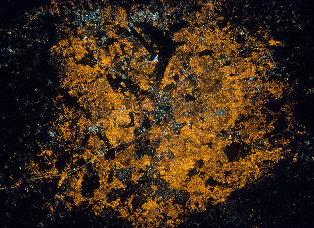
Fantastic image of Bengaluru from space taken by astronauts [src2], but I don't have information about it's orientation, scale or angle. If necessary, it was rotated manually, so North points approximately to upper direction. Click to zoom in:
Some cities around Bengaluru sort by population:
• Yelahanka
14.3 km =8.9 mi,  1°
1°
• Hosūr
36.8 km =22.9 mi,  135°
135°
• Dod Ballāpur
36.4 km =22.6 mi,  350°
350°
• Hoskote
24.7 km =15.3 mi,  63°
63°
• Anekal
31 km =19.3 mi,  159°
159°
• Mālūr
37.5 km =23.3 mi,  84°
84°
• Nelamangala
25.9 km =16.1 mi,  303°
303°
• Devanhalli
33.1 km =20.6 mi,  22°
22°
1277333 (p: 5,104,047)
Sources (retrieved 2019-11-25):
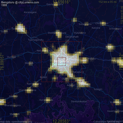
» NASA, Earths city lights 1995
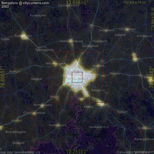
» NASA city lights 2003
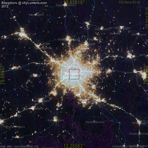
» Earth at Night: Flat Maps 2012, 2016
Src.2: NASA.gov ID: ISS050-E-41535, 2017-02-06