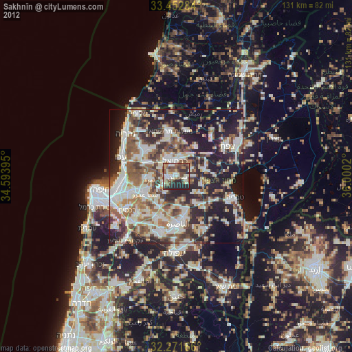
Sakhnīn night lights from space
Night Light of Sakhnīn (Northern District) from space (Israel) Src. Average luminocity for 10x10km area is 70.5842% and for 50x50km: 59.7118%.
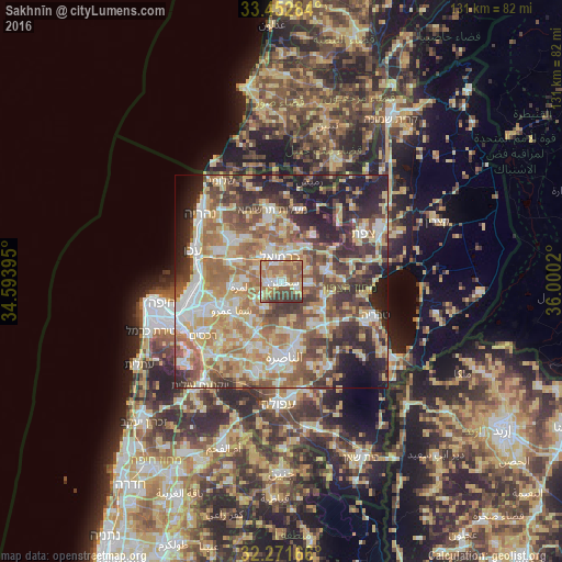
Analysis of Sakhnīn night lights 2016
Square area 10x10 km:
100  8.79%
8.79%
90-99 10.99%
80-89 17.22%
70-79 13.92%
60-69 19.78%
50-59 12.64%
40-49 8.97%
30-39 7.69%
20-29 0%
10-19 0%
0-9 0%
8.79%90-99
10.99%80-89
17.22%70-79
13.92%60-69
19.78%50-59
12.64%40-49
8.97%30-39
7.69%20-29
0%10-19
0%0-9
0%Square area 50x50 km:
100 8.66%
90-99 9.96%
80-89 13.59%
70-79 9.35%
60-69 10.59%
50-59 9.42%
40-49 9.7%
30-39 8.83%
20-29 10.14%
10-19 7.87%
0-9 1.88%
8.66%90-99
9.96%80-89
13.59%70-79
9.35%60-69
10.59%50-59
9.42%40-49
9.7%30-39
8.83%20-29
10.14%10-19
7.87%0-9
1.88%Clear (daylight) street map image can be seen on geolist.org.
Map coordinates:
33° 27' 10.2" North, 34° 35' 38.2" East
32° 51' 51.2" North, 35° 17' 49.5" East
32° 16' 18" North, 36° 0' 0.7" East
Some cities around Sakhnīn sort by population:
• Karmi’el
5.9 km =3.7 mi,  7°
7°
• Tamra
9.3 km =5.8 mi,  262°
262°
• Maghār
10.7 km =6.6 mi,  74°
74°
• Kafr Mandā
6.9 km =4.3 mi,  209°
209°
• Naḥf
8 km =5 mi, 13°
• Kābūl
8 km =5 mi,  273°
273°
• Deir Ḥannā
6.2 km =3.9 mi,  92°
92°
• Bu‘eina
9 km =5.6 mi,  135°
135°
293655 (p: 24,596)
Sources (retrieved 2019-11-25):
» Earth at Night: Flat Maps 2012, 2016