H̱olon night lights from space
Night Light of H̱olon (Tel Aviv) from space (Israel) Src. Average luminocity for 10x10km area is 94.2028% and for 50x50km: 54.2765%.
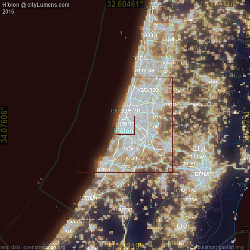
Analysis of H̱olon night lights 2016
Square area 10x10 km:
 54.37%
90-99
31.82%80-89
2.62%70-79
2.45%60-69
1.57%50-59
3.32%40-49
3.5%30-39
0.35%20-29
0%10-19
0%0-9
0%Square area 50x50 km:
18.05%90-99
15.46%80-89
10.44%70-79
5.56%60-69
3.56%50-59
4.93%40-49
3.33%30-39
1.79%20-29
2.2%10-19
3.37%0-9
31.32%Clear (daylight) street map image can be seen on geolist.org.
Map coordinates:
32° 36' 16.6" North, 34° 4' 33.8" East
32° 0' 37.2" North, 34° 46' 45" East
31° 24' 43.9" North, 35° 28' 56.3" East
Some cities around H̱olon sort by population:
• Tel Aviv
7.8 km =4.8 mi,  0°
0°
• Rishon LeẔiyyon
4.5 km =2.8 mi,  167°
167°
• Bat Yam
3 km =1.9 mi,  300°
300°
• Jaffa
5.1 km =3.2 mi,  330°
330°
• Givatayim
7.6 km =4.7 mi,  24°
24°
• Or Yehuda
7.7 km =4.8 mi,  74°
74°
• Azor
3 km =1.9 mi,  58°
58°
• Bet Dagan
4.9 km =3 mi,  101°
101°
294751 (p: 165,787)
Sources (retrieved 2019-11-25):
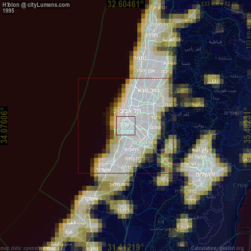
» NASA, Earths city lights 1995
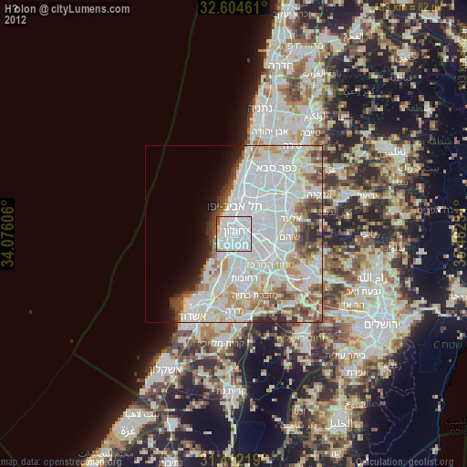
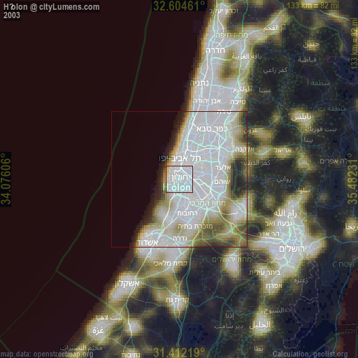
» NASA city lights 2003
» Earth at Night: Flat Maps 2012, 2016