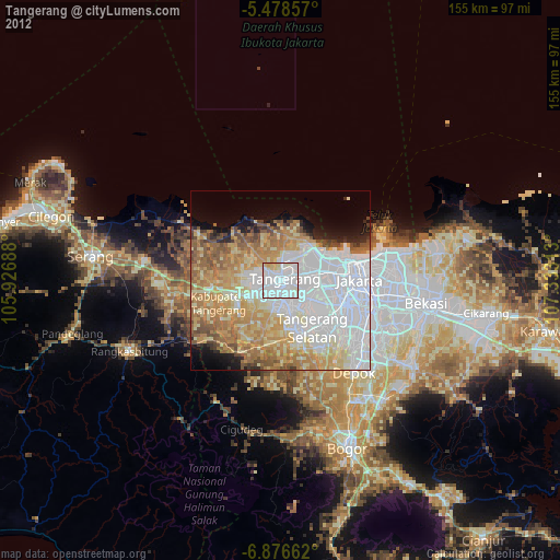
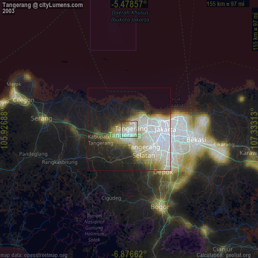
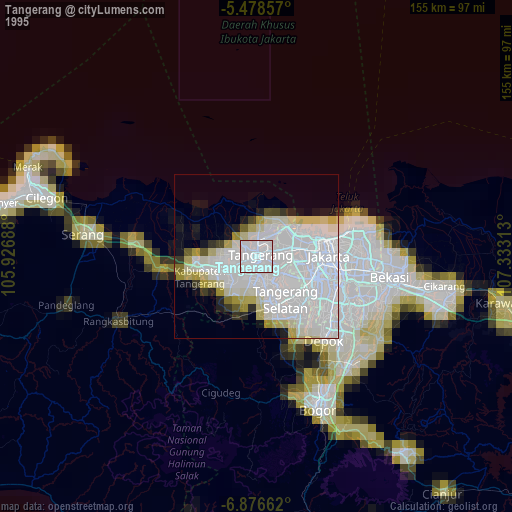
Tangerang night lights from space
Night Light of Tangerang (Banten) from space (Indonesia) Src. Average luminocity for 10x10km area is 98.9525% and for 50x50km: 58.4674%.
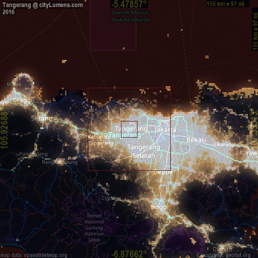
Analysis of Tangerang night lights 2016
Square area 10x10 km:
 84.3%
84.3%90-99
10.95%80-89
4.75%70-79
0%60-69
0%50-59
0%40-49
0%30-39
0%20-29
0%10-19
0%0-9
0%Square area 50x50 km:
28.45%90-99
9.3%80-89
4.72%70-79
4.76%60-69
5.4%50-59
5.89%40-49
5.85%30-39
5.14%20-29
4.24%10-19
6.04%0-9
20.21%Clear (daylight) street map image can be seen on geolist.org.
Map coordinates:
5° 28' 42.9" South, 105° 55' 36.8" East
6° 10' 41" South, 106° 37' 48" East
6° 52' 35.8" South, 107° 19' 59.3" East
Some cities around Tangerang sort by population:
• South Tangerang
15.7 km =9.8 mi,  141°
141°
• Ciputat
9.8 km =6.1 mi,  132°
132°
• Curug
12.7 km =7.9 mi,  219°
219°
• Cikupa
14.9 km =9.3 mi,  244°
244°
• Pasarkemis
11.1 km =6.9 mi,  274°
274°
• Teluknaga
8.8 km =5.5 mi,  5°
5°
• Sepatan
9 km =5.6 mi,  317°
317°
• Serpong
15.9 km =9.9 mi,  166°
166°
1625084 (p: 1,372,124)
Sources (retrieved 2019-11-25):
» NASA, Earths city lights 1995
» NASA city lights 2003
» Earth at Night: Flat Maps 2012, 2016