Sidoarjo night lights from space
Night Light of Sidoarjo (East Java) from space (Indonesia) Src. Average luminocity for 10x10km area is 86.1797% and for 50x50km: 55.0475%.
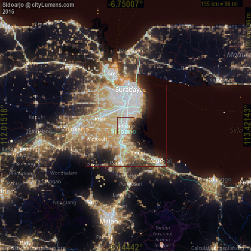
Analysis of Sidoarjo night lights 2016
Square area 10x10 km:
 31.82%
90-99
31.39%80-89
8.87%70-79
9.74%60-69
7.58%50-59
1.73%40-49
2.38%30-39
4.76%20-29
1.73%10-19
0%0-9
0%Square area 50x50 km:
12.93%90-99
13.07%80-89
9.83%70-79
12.04%60-69
6.24%50-59
3.8%40-49
5.18%30-39
3.9%20-29
5.65%10-19
6.77%0-9
20.58%Clear (daylight) street map image can be seen on geolist.org.
Map coordinates:
6° 45' 0.3" South, 112° 0' 54.6" East
7° 26' 52.1" South, 112° 43' 5.9" East
8° 8' 39.9" South, 113° 25' 17.1" East
Some cities around Sidoarjo sort by population:
• Surabaya
22.4 km =13.9 mi,  9°
9°
• Bangil
20.2 km =12.6 mi,  146°
146°
• Gedangan
6.4 km =4 mi, 8°
• Tulangan Utara
8 km =5 mi,  248°
248°
• Buduran
2.3 km =1.4 mi, 14°
• Krian
15.9 km =9.9 mi,  285°
285°
• Tanggulangin
6.1 km =3.8 mi,  199°
199°
• Driyorejo
14 km =8.7 mi,  310°
310°
1627253 (p: 139,189)
Sources (retrieved 2019-11-25):
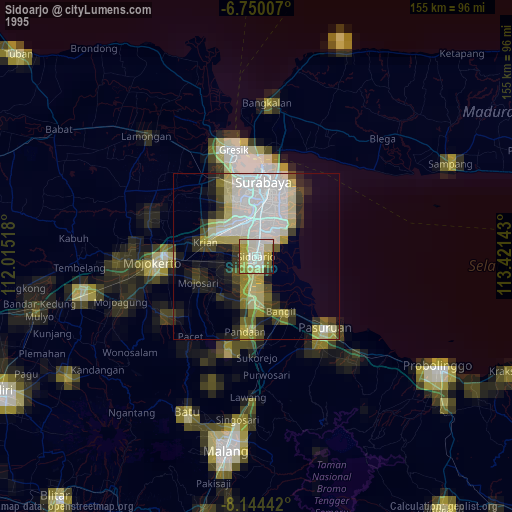
» NASA, Earths city lights 1995
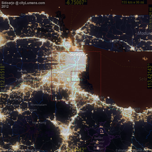
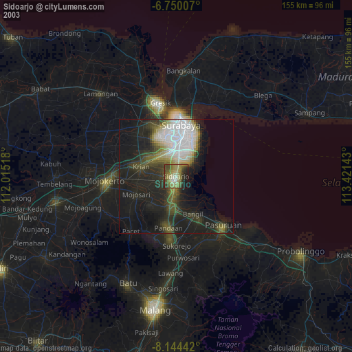
» NASA city lights 2003
» Earth at Night: Flat Maps 2012, 2016