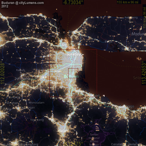
Buduran night lights from space
Night Light of Buduran (East Java) from space (Indonesia) Src. Average luminocity for 10x10km area is 87.1472% and for 50x50km: 55.1757%.
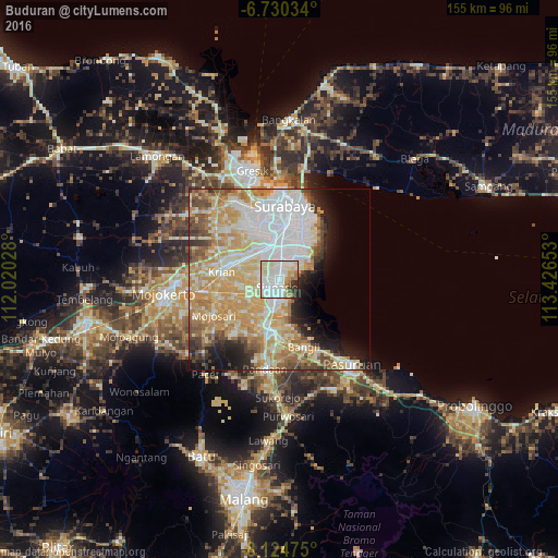
Analysis of Buduran night lights 2016
Square area 10x10 km:
 33.55%
90-99
33.33%80-89
9.96%70-79
5.84%60-69
6.93%50-59
1.73%40-49
1.73%30-39
4.98%20-29
1.95%10-19
0%0-9
0%Square area 50x50 km:
13.38%90-99
13.15%80-89
9.85%70-79
12.31%60-69
6.31%50-59
3.78%40-49
4.47%30-39
3.19%20-29
5.27%10-19
6.69%0-9
21.61%Clear (daylight) street map image can be seen on geolist.org.
Map coordinates:
6° 43' 49.2" South, 112° 1' 13" East
7° 25' 41.2" South, 112° 43' 24.2" East
8° 7' 29.1" South, 113° 25' 35.5" East
Some cities around Buduran sort by population:
• Surabaya
20.1 km =12.5 mi,  8°
8°
• Sidoarjo
2.3 km =1.4 mi,  194°
194°
• Bangil
21.7 km =13.5 mi,  151°
151°
• Gedangan
4.2 km =2.6 mi,  4°
4°
• Tulangan Utara
9.5 km =5.9 mi,  237°
237°
• Krian
16 km =9.9 mi,  277°
277°
• Tanggulangin
8.4 km =5.2 mi,  198°
198°
• Driyorejo
13.2 km =8.2 mi,  301°
301°
1647936 (p: 48,152)
Sources (retrieved 2019-11-25):
» Earth at Night: Flat Maps 2012, 2016